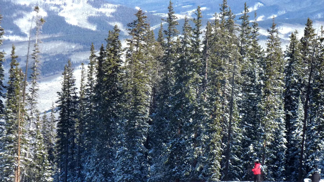
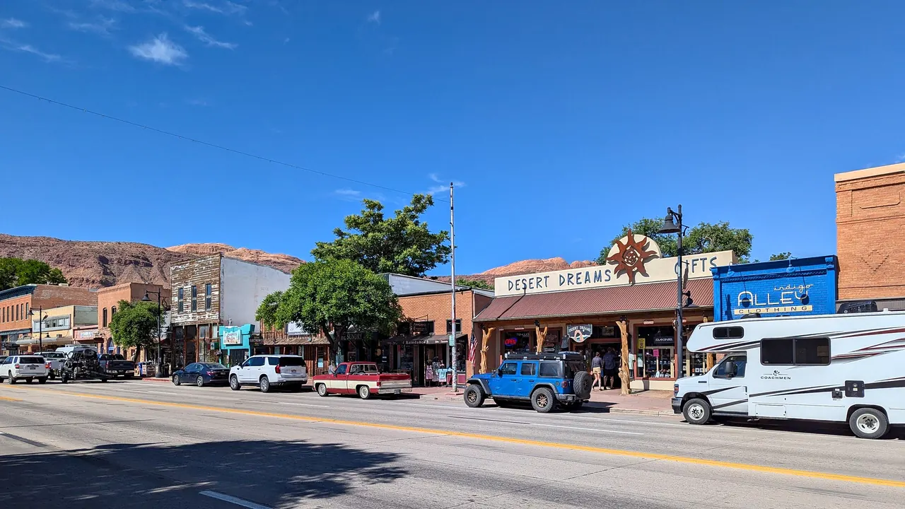
Photos: Beaver Creek by Joe Lin, CC BY 2.0, cropped; Moab by G. Edward Johnson, CC BY 4.0, cropped.
Beaver Creek or Moab?
Our verdict in twelve categories, each scored against the same fixed benchmark cities, and the climate month by month, so you can choose for your trip.
Choose Beaver Creek for
- getting around
- wellness
- day trips
Beaver Creek is for a ski trip or a comfortable mountain summer where the work has been done for you. It has a large ski school, ski-in ski-out lodging, free shuttles, big spas and a season of orchestras and dance just down the valley in Vail. It is the better pick for families and for anyone who wants polished dinners and a quiet, well-run village, as long as the budget can cope with one of the most expensive resorts in North America.
Choose Moab for
- prices
- culture and sights
- nature and the outdoors
Moab is the place when the landscape itself is the reason for going. Arches and Canyonlands, slickrock mountain biking, rafting on the Colorado and petroglyph panels beside the road make it a base for active travellers who drive themselves and are happy with burgers, motels and early nights. It costs less, especially if you camp, but you will need a car, and in high summer the heat decides how each day goes.
Scoreboard
Twelve categories on one fixed scale from 0 to 100. The shaded stretch is the gap between the two.
Your match
Pick a travel style or drag the sliders, and both match scores follow your weighting.
Wins on getting around and wellness with your weighting.
Wins on prices and culture and sights with your weighting.
What matters to you?
Category by category
What the scores mean for a trip.
Beaches & swimming
Neither place is anywhere near a coast, and in both, swimming is an afterthought. Beaver Creek has the small sandy swimming area at Nottingham Lake down in Avon, fed by chilly snowmelt, and heated outdoor pools with mountain views.
Moab's options are wilder: shallow pools in Mill Creek, Ken's Lake and sandbars along a Colorado River that is fast and silty enough to need care. In practice, most visitors in both places swim in their hotel or motel pool at the end of the day.
Food & drink
Beaver Creek eats better. The village serves refined mountain cooking with elk, Colorado lamb and trout, and some dinners are reached by chairlift or snowcat sleigh. Cheaper taquerias and diners are in Avon and Edwards, and Vail adds more choice. The menus can feel alike from one kitchen to the next, but the standard is high.
Moab's food is for refuelling: burgers, tacos, pizza and brewery meals on Main Street, with only a few more ambitious places using Southwestern flavours. Utah's alcohol rules make a drink with dinner more formal, evenings in spring and autumn bring queues, and choice gets thinner in winter.
Culture & sights
Neither is a culture destination, but what each has differs. Beaver Creek is a resort built around 1980, with handsome stone-and-timber buildings and outdoor art on the plaza. You can see it in an hour, and real history means driving to the old mining towns.
Moab's town is plain, but its surroundings go back much further. Ancestral Puebloan and Fremont petroglyph panels line the cliffs along Potash Road and Kane Creek, there are dinosaur trackways nearby, and the small Museum of Moab explains the geology and settlement history.
Nightlife
Both places go quiet early, and the evenings feel different. In Beaver Creek, the evening is a cocktail by a fire pit on the plaza after the lifts close, then a hotel lounge, and anyone wanting more drives to Vail. Moab's evenings take place in a couple of brewpubs full of dusty mountain bikers and rafters, with one or two staying open late on busy weekends. The town's best night-time sight is the very dark, star-filled sky.
Nature & outdoors
Both are first-rate outdoor bases, and the difference is in the kind of landscape and the season. Beaver Creek is a mountain resort. Its uncrowded slopes rise to about 3,500m and connect by lift to Bachelor Gulch and Arrowhead, and Vail's huge ski area is a short ride away. In summer, aspen forest trails lead into the Holy Cross Wilderness and the Gore Range, and the rivers offer gold-medal fly-fishing and rafting.
Moab is red-rock desert. Arches starts on the edge of town, there are canyon views from Island in the Sky and Dead Horse Point, mountain bikers have the Slickrock Trail and the Whole Enchilada descent, and there is canyoneering and climbing as well. Choose Beaver Creek for snow or a summer in the forest, and Moab for arches and canyons in spring and autumn.
Day trips
Beaver Creek has more towns within easy reach. Vail is about twenty minutes away, and Leadville's Victorian silver-mining street, Breckenridge's gold-rush centre and the old spa town of Glenwood Springs are each about an hour's drive. They are similar mountain towns, but each is easy to visit.
From Moab, the towns are small and far apart. Bluff's pioneer stone houses are about two hours south, and the Ancestral Puebloan ruins at Edge of the Cedars and Hovenweep take most of a day. Most days out from Moab are really more landscape.
Good for families
Beaver Creek works for a wider range of ages. It has covered escalators up from the car parks, a car-free plaza, warm cookies when the lifts close and a hilltop ropes and climbing area in summer. Its weak points are bad-weather days with no zoo or museum, and altitude that tires small children at first.
Moab suits school-age children who like scrambling over rocks. They can try Junior Ranger programmes, short walks to Sand Dune Arch, dinosaur tracks and calm raft floats. Toddlers are a harder fit because of the summer heat and the hours in the car.
Getting around
Getting around Beaver Creek without driving is much easier. The village is pedestrian, many lodgings are ski-in ski-out, free shuttles link the hillside and Avon, valley buses run to Vail, and Eagle airport is about half an hour away. A car only really matters for outings further afield and for winter passes.
In Moab you can walk along Main Street and cycle a paved path to the Arches entrance, but that is about all. There is no useful public transport, trailheads are often at the end of dirt tracks, and without your own vehicle, ideally a high-clearance one, you depend on outfitters' tours.
Shopping & style
Neither is a shopping trip, though Beaver Creek has a little more to browse. Its plaza has technical ski wear, luxury outerwear, western boots and galleries selling bronze sculpture, all expensive.
Moab's Main Street is more practical: bike and climbing shops for spare parts, rock shops with geodes and fossils, and a few galleries selling Navajo jewellery and weavings that make better souvenirs of the region.
Affordability
Moab is far easier on the wallet. Its motels charge resort prices in spring and autumn, and car hire and guided rafting add up. But camping on public land is cheap or free, the hikes cost nothing, and winter is much cheaper.
Beaver Creek is expensive at every step: luxury lodging, lift tickets, rental and ski school. Staying down the valley in Avon, buying passes early or coming in summer helps a little, but it never becomes cheap.
Live music & performing arts
Beaver Creek has far more to offer. The village has its own theatre, the Vilar Performing Arts Center, which hosts touring concerts, dance and family shows in winter and summer. In summer, Bravo! Vail brings leading orchestras to the open-air amphitheatre twenty minutes away, and the Vail Dance Festival follows.
Moab has one great occasion, the Moab Music Festival at the end of summer, with chamber concerts in canyon grottoes reached by boat. The rest of the year there is little beyond a weekend band in a brewpub.
Wellness & relaxation
Beaver Creek is the place to rest. Its resort spas are among the largest in the Rockies, with outdoor hot tubs in the snow, and the mineral pools at Glenwood Springs, used by bathers since the 1880s, are about an hour west.
Moab has only a few massage studios, and its days are early and energetic. What it offers is quiet: cliffs turning red at sunset and silent desert nights. For real rest, people head out to a ranch or a cabin in the La Sal Mountains.
When should you go?
Pick your month. The climate figures are measured averages, not a forecast.
Beaver Creek in July
Moab in July
Daytime high, °C
Rainfall in the month, mm
Where the figures come from
Beaver Creek's temperatures are measured 34 km from the centre, at Eagle County / Gypsum.
Beaver Creek's station stands 268 m below the city centre, so the centre is likely a little cooler than the figures say.
Beaver Creek has no rain gauge within 25 km of the centre, so its rainfall comes from a gridded climate dataset read at the city rather than from a gauge further away.
Moab's temperatures are measured 27 km from the centre, at Moab / Crescent Junction.
Moab's station stands 162 m above the city centre, so the centre is likely a little warmer than the figures say.
Moab has no rain gauge within 25 km of the centre, so its rainfall comes from a gridded climate dataset read at the city rather than from a gauge further away.
Temperature and rainfall are climate normals, averaged over the years shown. Beaver Creek: 1992-2020 (rainfall 1991-2020) normals, Eagle County / Gypsum (33.8 km from centre). Moab: 2006-2020 (rainfall 1991-2020) normals, Moab / Crescent Junction (27 km from centre).
The two places are at their best at almost opposite times of year. Beaver Creek has two main seasons. Winter is for skiing, from December into April, with daytime highs around 1°C in midwinter. Summer is warm and pleasant for hiking and biking, reaching about 29°C in July. Rain is light all year and only slightly heavier in late summer, so weather costs you few days. Spring and late autumn are the quiet months in between.
Moab is best in spring and autumn. Days in April and October reach about 20°C, which is ideal for long hikes and rides. From June to August highs climb to around 35°C, too hot for walking among the rocks in the middle of the day. Winter days stay close to freezing, and the trails are cold and empty. Moab is also the drier of the two, and no month gets more than 25mm of rain. This means the months when Moab is too hot are Beaver Creek's best summer months, and Moab's pleasant spring falls while Beaver Creek is still in the last weeks of its ski season.
Which traveller are you?
On a family trip with children, Beaver Creek is the easier choice. Its ski school, gentle children's terrain, ice rink and summer adventure area are all designed for kids. Moab means long drives, unfenced drops and careful timing around the heat.
For a relaxing and wellness trip, Beaver Creek is clearly better. It has large resort spas with outdoor hot tubs, calm car-free evenings, and the Glenwood Springs hot springs within an hour. In Moab, days start before dawn and the few spas mostly treat sore cyclists.
On a trip on a tight budget, Moab is the only realistic option. Rooms are not cheap, but one park pass lasts a week, public and free camping are plentiful and the best hikes cost nothing. Beaver Creek has no budget way in.
Before you go
| Measure | Beaver Creek | Moab |
|---|---|---|
| Currency | US Dollar (USD) | US Dollar (USD) |
| Sockets | AB120 V, 60 Hz | AB120 V, 60 Hz |
| Driving side | Right | Right |
| Time zone | UTC-7, UTC-6 in summer | UTC-7, UTC-6 in summer |
| Emergency number | 911 | 911 |
| Elevation | 2,264 m | 1,227 m |
| Main airport | Eagle County Regional Airport (EGE)34 km from centre16 non-stop destinations | Canyonlands Regional Airport (CNY)27 km from centre2 non-stop destinations |
| Public holidays this year | 12 days | 12 days |
By the numbers
| Measure | Beaver Creek | Moab |
|---|---|---|
| City population | - | 5,366 |
| People per km² | - | 501 |
| Museums within 10 km | 0 | 1 |
| UNESCO World Heritage sites within 50 km | 0 | 0 |
Where else could you go?
Every comparison below shares a destination with this one, so you can follow Beaver Creek or Moab somewhere new.
- Vailvs Beaver Creek
- Copper Mountainvs Beaver Creek
- Breckenridgevs Beaver Creek
- Keystonevs Beaver Creek
- Aspenvs Beaver Creek
- Winter Park, Coloradovs Beaver Creek