
VacationSelector
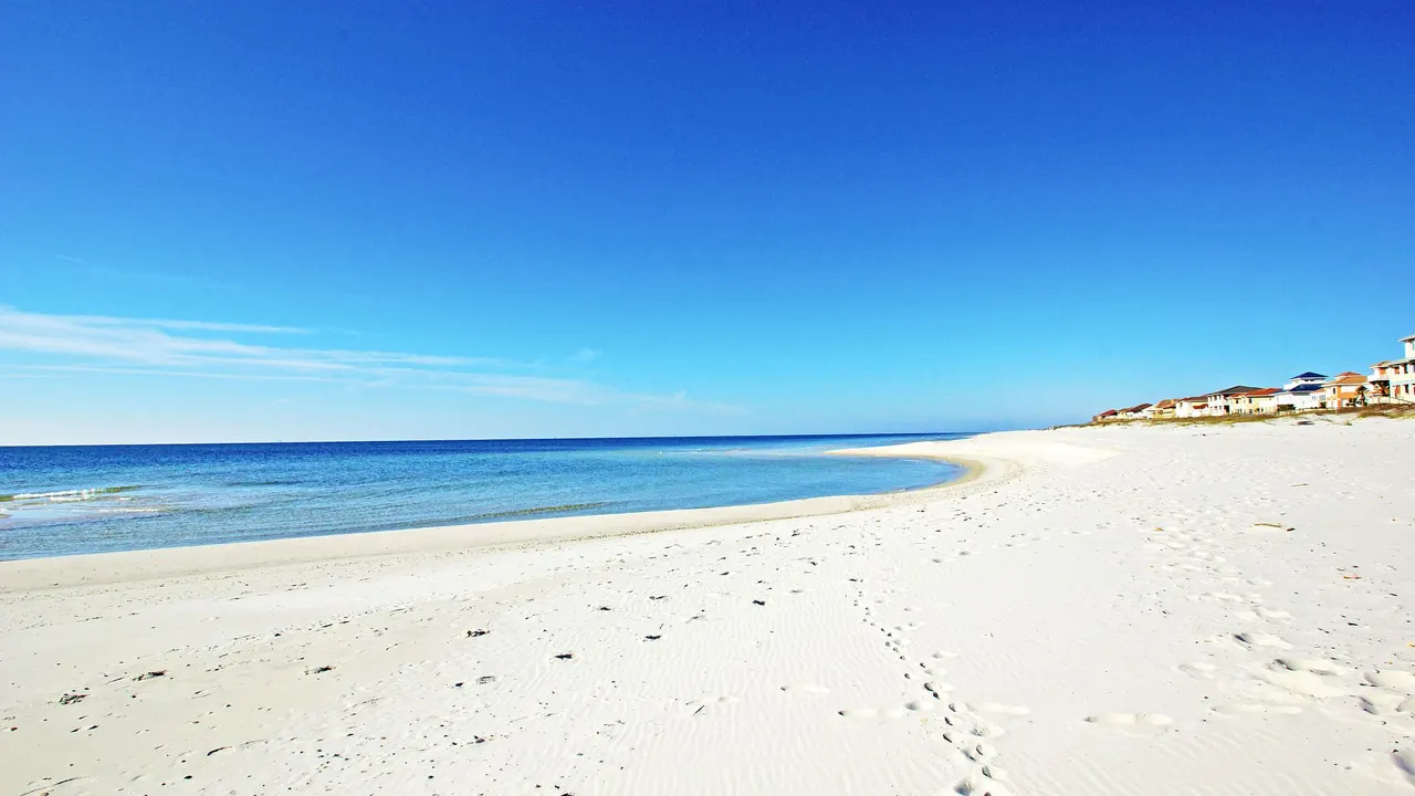
White sand and the turquoise Gulf of Mexico, Gulf Shores
Gulf ShoresWhite sand and the turquoise Gulf of Mexico
Kek Lok Si temple on the hillside, Penang
PenangKek Lok Si temple on the hillside

Photos: Gulf Shores by ourgulfshoresvacation.com, CC BY-SA 4.0, cropped; Penang by Supanut Arunoprayote, CC BY 4.0, cropped.

Gulf Shores or Penang?

Our verdict in twelve categories, each scored against the same fixed benchmark cities, and the climate month by month, so you can choose for your trip.

Choose Gulf Shores for

  • beaches
  • families
  • day trips

What lies behind each score is written up on Gulf Shores’s own page.

Choose Penang for

  • culture and sights
  • food and drink
  • prices

What lies behind each score is written up on Penang’s own page.

Scoreboard

Twelve categories on one fixed scale from 0 to 100. The shaded stretch is the gap between the two.

Beaches & swimming. Gulf Shores 84, Penang 44: Gulf Shores leads by 40 points.
Food & drink. Gulf Shores 38, Penang 86: Penang leads by 48 points.
Culture & sights. Gulf Shores 12, Penang 70: Penang leads by 58 points.
Nightlife. Gulf Shores 32, Penang 40: Penang leads by 8 points.
Nature & outdoors. Gulf Shores 52, Penang 55: Penang leads by 3 points.
Day trips. Gulf Shores 52, Penang 42: Gulf Shores leads by 10 points.
Good for families. Gulf Shores 75, Penang 52: Gulf Shores leads by 23 points.
Getting around. Gulf Shores 15, Penang 40: Penang leads by 25 points.
Shopping & style. Gulf Shores 22, Penang 42: Penang leads by 20 points.
Affordability. Gulf Shores 42, Penang 78: Penang leads by 36 points.
Live music & performing arts. Gulf Shores 27, Penang 30: Penang leads by 3 points.
Wellness & relaxation. Gulf Shores 28, Penang 42: Penang leads by 14 points.
0255075100

What lies behind each score is written up on the two cities’ own pages: Gulf Shores and Penang.

Your match

Pick a travel style or drag the sliders, and both match scores follow your weighting.

Gulf Shores
40match

Wins on beaches and families with your weighting.

Penang
Best match
52match

Wins on culture and sights and food and drink with your weighting.

What matters to you?

When should you go?

Pick your month. The climate figures are measured averages, not a forecast.

Gulf Shores in July

32 °Cdaytime high
24 °Cnight-time low
165 mmrain in the month
29 °Csea
14 hdaylight a day

Penang in July

32 °Cdaytime high
25 °Cnight-time low
189 mmrain in the month
30 °Csea
12 hdaylight a day

Daytime high, °C

0°10°20°30°40°JFMAMJJASOND

Rainfall in the month, mm

0100200300400JFMAMJJASOND
Gulf ShoresPenang

Where the figures come from

Gulf Shores has no rain gauge within 25 km of the centre, so its rainfall comes from a gridded climate dataset read at the city rather than from a gauge further away.

Temperature and rainfall are climate normals, averaged over the years shown. Gulf Shores: 2006-2020 (rainfall 1991-2020) normals, Gulf Shores / Bay Village Mobile Home Park (3.7 km from centre). Penang: 1991-2020 normals, Penang / Bayan Lepas (14.5 km from centre).

Before you go

MeasureGulf ShoresPenang
Official language-Malay
CurrencyUS Dollar (USD)Malaysian Ringgit (MYR)
SocketsAB120 V, 60 HzG240 V, 50 Hz
Driving sideRightLeft
Time zoneUTC-6, UTC-5 in summerUTC+8
Emergency number911999
Elevation2 m4 m
Main airportPensacola International Airport (PNS)54 km from centre27 non-stop destinationsPenang International Airport (PEN)14 km from centre32 non-stop destinations
Public holidays this year13 days-

By the numbers

MeasureGulf ShoresPenang
City population15,014794,313
People per km²207-
Museums within 10 km19
UNESCO World Heritage sites within 50 km01
Swim season, months above 21 °C8 months12 months

Where else could you go?

Every comparison below shares a destination with this one, so you can follow Gulf Shores or Penang somewhere new.

Browse every destination

Sources

Structured data from Wikidata (CC0). Weather data by Meteostat. Meteorological data provided by NOAA, DWD and others. Rainfall where no rain gauge is within 25 km is from the TerraClimate 1991-2020 climatology (Abatzoglou et al. 2018, Scientific Data), read at the city. Sea surface temperature from NOAA OISST v2.1, NOAA Physical Sciences Laboratory. Airport data from OurAirports (public domain). Public holidays from Nager.Date (MIT). Exchange rates via Frankfurter, based on European Central Bank reference rates. Non-stop route lists from the "Airlines and destinations" tables on English Wikipedia airport articles, by Wikipedia contributors, reused under CC BY-SA 4.0. Currency from the ISO 4217 register maintained by SIX, cross-checked against country data from GeoNames (CC BY 4.0). Price level from World Bank open data (PPP conversion factor for private consumption and official exchange rate), CC BY 4.0. Time zones from GeoNames (CC BY 4.0); clock offsets computed from the IANA time zone database. Daylight hours computed from each destination's latitude using the NOAA solar position algorithm.

Category scores are our editorial verdict under rubric v3, each placed against the same fixed benchmark cities; the climate figures are measured. How the scores are set. Snapshot generated 2026-11-02. Daily budgets are estimates from country price levels.