Costa Rica
Tamarindo
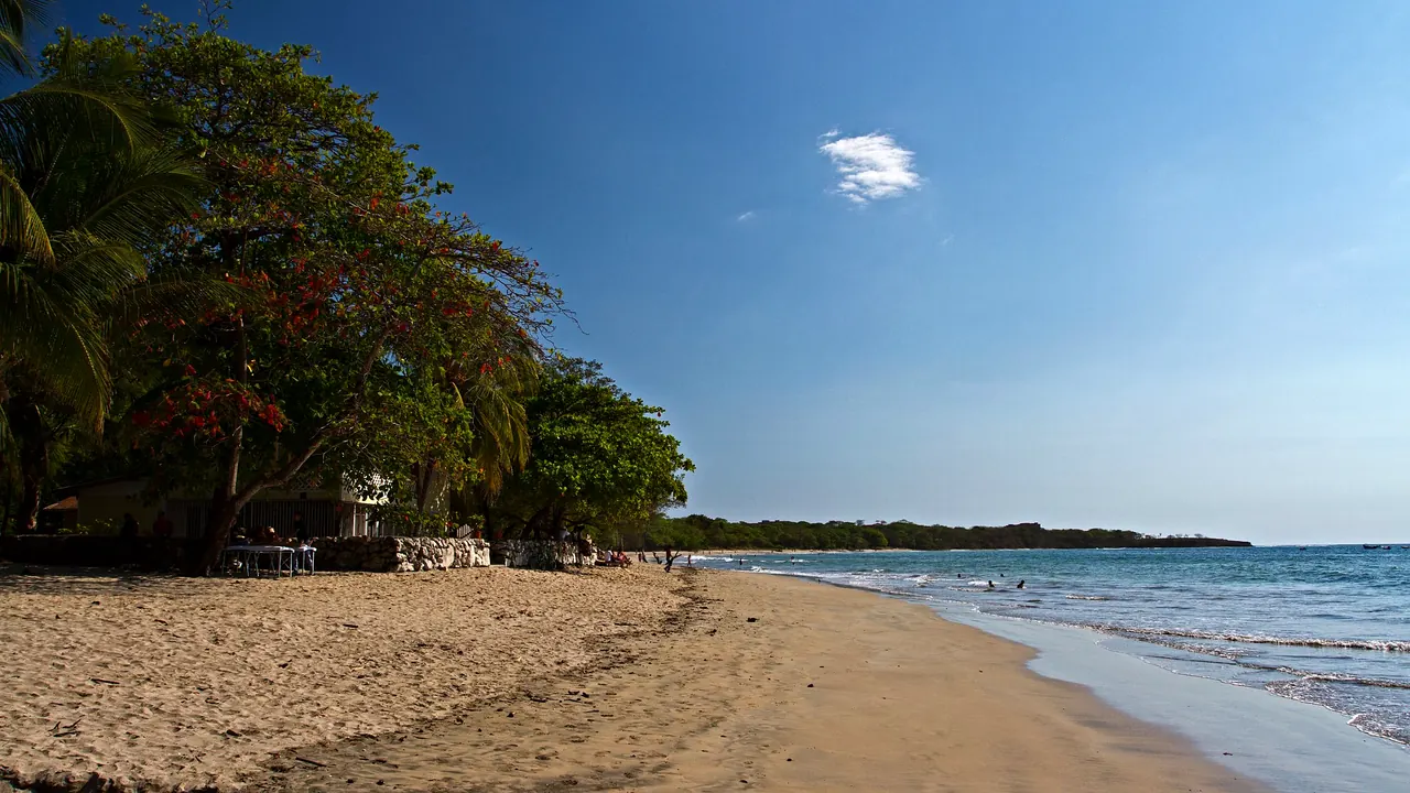
Playa Tamarindo
- Beaches85
- Nature & outdoors76
- Families55
Photo: Jarle Naustvik, CC BY 2.0, cropped
Match
39
Every category weighted equally
- Beach & sun48
- Culture & arts29
- Food & nightlife34
- Family trip45
- Outdoors46
- Relax & unwind45
- Shopping & style33
- On a budget39
Tamarindo in twelve categories
Our verdict on each, scored 0 to 100 against the same fixed benchmark cities, so a score means the same thing on every page.
Beaches & swimming. Scores 85 out of 100.
Food & drink. Scores 38 out of 100.
Culture & sights. Scores 5 out of 100.
Nightlife. Scores 45 out of 100.
Nature & outdoors. Scores 76 out of 100.
Day trips. Scores 28 out of 100.
Good for families. Scores 55 out of 100.
Getting around. Scores 32 out of 100.
Shopping & style. Scores 18 out of 100.
Affordability. Scores 36 out of 100.
Live music & performing arts. Scores 10 out of 100.
Wellness & relaxation. Scores 45 out of 100.
Tamarindo category by category
Beaches & swimming
85The beach is why anyone comes to Tamarindo. The town faces a long, gently curving bay of golden sand on the Pacific, with water around 28°C all year and gentle, consistent waves that make it one of the easiest places in Central America to learn to surf. Days follow the tide: board lessons in the morning, a swim at the quieter southern end, sunset from the sand when the whole town turns out.
The variety within reach is the real strength. Playa Langosta, just south, is calmer and less built up. Playa Grande across the estuary is long and wild, and Avellanas and Playa Negra to the south suit stronger surfers. About 30 minutes' drive north, Playa Conchal has crushed-shell sand and clearer, calmer water for snorkelling. Rip currents are common on the open beaches, and crocodiles live in the river mouth at the north end, so swim away from it. The wet season from May to November brings afternoon storms but still warm sea.
Food & drink
38For a small beach town, Tamarindo eats better than you might expect, largely because of the many foreign residents who have settled here. The main strip and the side roads behind the beach hold fish taco stands, poke and smoothie bowls, wood-fired pizza, Argentine grills and a handful of more ambitious dinner places. The local layer is the soda, a simple Costa Rican diner serving casados of rice, beans, plantain and grilled fish or chicken, and ceviche made with the day's catch.
What it lacks is depth and a strong cuisine of its own. Much of the menu is pitched at visitors, there is no real market culture, and after a week the choices start to repeat. Coffee from the Costa Rican highlands is good and easy to find.
Culture & sights
5Tamarindo has essentially no sights in the cultural sense. It grew from a fishing village into a surf resort, and the town is a strip of hotels, restaurants and surf shops with no museums, historic architecture or monuments. Visitors interested in Costa Rican heritage need to head inland to the older towns of the Nicoya Peninsula.
Nightlife
45Tamarindo has a reputation as the party town of the Guanacaste coast, and it lives up to it on a small scale. Evenings start with drinks on the sand at sunset, move to open-air bars along the main road, and on busy nights end at one of a few dance clubs with reggaeton and electronic music. Different venues take turns hosting the big night of the week, so there is something on most evenings, drawing surfers, backpackers and young Costa Ricans on weekends.
It is lively rather than deep: a few blocks, the same crowd and limited variety. Families and couples staying at Langosta or Playa Grande will barely notice it.
Nature & outdoors
76The outdoors here is about the sea and the wildlife around it. Surfing is the main activity, with gentle breaks for beginners in town and more demanding reefs and point breaks a short drive away. Other outings include snorkelling and diving trips to the Catalinas Islands, sportfishing, sailing at sunset and kayaking through the mangroves of the Tamarindo estuary, where crocodiles, herons and howler monkeys are easy to spot.
Playa Grande, across the river, is part of Las Baulas National Park, a nesting beach for leatherback turtles on night-time guided visits in season. About two hours inland, Rincon de la Vieja National Park has fumaroles, mud pots, waterfalls and dry-forest trails on the slopes of an active volcano. The surrounding landscape is tropical dry forest, green in the wet season and brown and dusty from December to April.
Day trips
28Most excursions from Tamarindo are into nature rather than to other towns. Among places to visit, the strongest is Guaitil, a village about 45 minutes inland where families make Chorotega-style pottery from local clay and fire it in traditional kilns. Nicoya, about an hour away, has one of the oldest colonial churches in Costa Rica, and Santa Cruz is the region's folkloric centre.
Other beach towns along the coast, such as the fishing village of Playas del Coco or the yoga and surf settlement of Nosara, make a change of scene, though the roads can be slow and rough in the wet season. Beyond that, the list runs short.
Good for families
55Tamarindo works well for families who want a beach and outdoor vacation. The waves at the town beach are gentle enough for children's surf lessons, the southern end and Langosta have calmer water at low tide, and boat trips to see monkeys and crocodiles in the mangroves or turtle nesting at night tend to delight children. Zip-line and horse-riding outings are easy to arrange, and many rentals and resorts have pools.
There are no zoos, aquariums or other attractions built for children, so the days revolve around the sea. Parents should watch for rip currents and keep away from the estuary. Families often stay at Langosta or Playa Grande to avoid the late noise of the main strip.
Getting around
32Within town, getting around is simple: Tamarindo is small, and walking along the sand is often quicker than the road, which has few pavements and fills with traffic and dust in the dry season. Golf carts, bicycles and scooters are popular for short hops to Langosta.
Beyond the town it becomes harder. Regional buses run to Santa Cruz and Liberia, but they are slow and do not reach most beaches, so visitors rely on shared shuttles, taxis, tours or a rental car. A four-wheel drive helps on the unpaved roads to the southern beaches, especially in the rainy season. Liberia's airport is a little over an hour's drive away.
Shopping & style
18Shopping in Tamarindo is mostly about the beach: surf shops for boards, wetsuits and rash guards, small boutiques selling swimwear and linen, and souvenir stands along the main road. Some stalls sell Guaitil pottery and wooden carvings, though buying directly in the village is more rewarding. There is a supermarket for self-catering, but nothing that would make a visitor plan a day around shopping.
Affordability
36Tamarindo is expensive for Central America. Costa Rica is the costliest country in the region, and this is one of its most popular resort towns, so hotel rooms, restaurant meals, drinks and guided tours run close to what visitors would pay at home in North America. Shuttles, taxis and rental cars add up quickly because so little is reachable on foot.
Budget travellers can manage with hostels, surf camps and the local sodas, where a casado costs far less than a meal on the beachfront, and the beach itself is free. Prices are highest from December to April, and quieter during the wet season.
Live music & performing arts
10There is no formal performing arts scene in Tamarindo. Live music means local bands and acoustic sets in beach bars and restaurants, along with occasional fire dancers on the sand. Traditional Guanacaste folk music and dance appear mostly at regional festivals in Santa Cruz rather than in town.
Wellness & relaxation
45Wellness in Tamarindo means yoga and an easy beach rhythm rather than baths. Several studios hold daily classes, retreats pair surfing with yoga, and massage and spa treatments are easy to find, from simple beach tables to resort spas. Langosta and Playa Grande are quieter than the town centre and suit a slower stay of early swims, hammocks and sunsets.
There is no bathing tradition, and the nearest hot springs, fed by volcanic heat around Rincon de la Vieja, are about two hours away. The main strip, with its traffic and late bars, is not restful, so where you stay largely decides how calm the visit feels.
When should you go?
Pick a month to see what it is like. The climate figures are measured averages, not a forecast.
Tamarindo in July
Daytime high, °C
Rainfall in the month, mm
The whole year
Shaded against this city’s own year: the deepest cell is its best month for that figure and the palest its weakest.
Where the figures come from
Tamarindo's temperatures are measured 54 km from the centre, at Liberia.
Tamarindo has no rain gauge within 25 km of the centre, so its rainfall comes from a gridded climate dataset read at the city rather than from a gauge further away.
Temperature and rainfall are climate normals, averaged over the years shown. Tamarindo: 1991-2020 normals, Liberia (53.8 km from centre).
Before you go
| Measure | Tamarindo |
|---|---|
| Official language | Spanish |
| Currency | Costa Rican Colon (CRC) |
| Sockets | AB120 V, 60 Hz |
| Driving side | Right |
| Time zone | UTC-6 |
| Emergency number | 911 |
| Elevation | 27 m |
| Main airport | Daniel Oduber Quirós International Airport (LIR)43 km from centre30 non-stop destinations |
| Public holidays this year | 11 days |
By the numbers
| Measure | Tamarindo |
|---|---|
| City population | 7,132 |
| People per km² | 57 |
| Museums within 10 km | 0 |
| UNESCO World Heritage sites within 50 km | 0 |
| Swim season, months above 21 °C | 12 months |
Compare Tamarindo with
Every comparison with a written verdict behind it.