Mexico
Riviera Nayarit
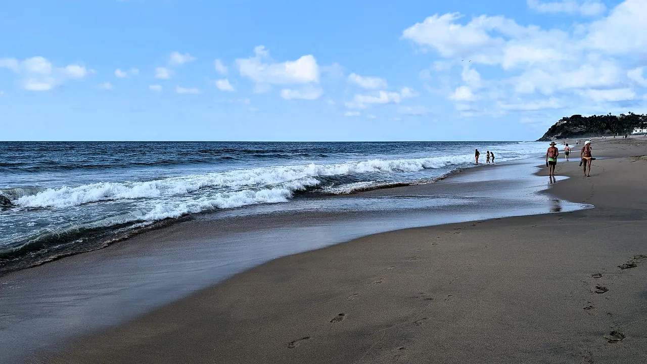
Playa Los Muertos at Sayulita
- Beaches85
- Nature & outdoors76
- Families68
Photo: গীতাশ্ৰী গগৈ আপ্তে, CC BY-SA 4.0, cropped
Match
49
Every category weighted equally
- Beach & sun58
- Culture & arts40
- Food & nightlife43
- Family trip56
- Outdoors57
- Relax & unwind57
- Shopping & style44
- On a budget50
Riviera Nayarit in twelve categories
Our verdict on each, scored 0 to 100 against the same fixed benchmark cities, so a score means the same thing on every page.
Beaches & swimming. Scores 85 out of 100.
Food & drink. Scores 58 out of 100.
Culture & sights. Scores 20 out of 100.
Nightlife. Scores 35 out of 100.
Nature & outdoors. Scores 76 out of 100.
Day trips. Scores 50 out of 100.
Good for families. Scores 68 out of 100.
Getting around. Scores 38 out of 100.
Shopping & style. Scores 32 out of 100.
Affordability. Scores 52 out of 100.
Live music & performing arts. Scores 15 out of 100.
Wellness & relaxation. Scores 64 out of 100.
Riviera Nayarit category by category
Beaches & swimming
85Beaches are the reason people come, and the coast offers a lot of them. The northern shore of Banderas Bay, from Nuevo Vallarta through Bucerías to La Cruz de Huanacaxtle, has long, wide stretches of sand on calm, shallow water. Beyond Punta de Mita the coast faces the open Pacific: Sayulita and San Pancho have livelier surf-town beaches, while sheltered coves at Rincón de Guayabitos, Lo de Marcos and Chacala are gentle enough for easy swimming.
Most visitors come between November and April, when the sea is around 23°C to 26°C. It warms to about 30°C in summer, the rainy season. On the exposed beaches, check the flags, because rip currents are common there.
Food & drink
58Most of the cooking worth seeking out is seafood. Nayarit is the home of pescado zarandeado, whole butterflied fish grilled over coals, and its aguachile, ceviche and shrimp tamales are served at beach shacks on the sand all along the coast. Bucerías and La Cruz de Huanacaxtle have relaxed seafront restaurants and a fishing-port market feel. Sayulita has taco stands, juice bars and casual international places, and the Punta de Mita peninsula has a polished resort dining tier.
The weak point is depth. Away from the beach shacks and the better town kitchens, a lot of the food is all-inclusive buffets and dishes cooked to tourist tastes. A visitor wanting a wider restaurant scene drives south into neighbouring Puerto Vallarta.
Culture & sights
20This is a stretch of beach towns rather than a heritage destination. The most history is in San Blas at the northern end, where the hilltop ruins of an eighteenth-century Spanish fort and church overlook a former colonial port. Near Las Varas, the Altavista petroglyphs are rock carvings beside a jungle stream that is still a sacred site for the Huichol. The Huichol are best known to visitors for their yarn paintings and beadwork, sold in the towns. Beyond these, the sights are pretty village plazas and small churches, so culture is an occasional outing, not something to plan a trip around.
Nightlife
35Evenings are mostly quiet. Sayulita is the exception: its small plaza and the surrounding streets fill with surfers and young travellers in beach bars and mezcal spots, and things stay sociable until late in the winter season. Bucerías has a few seafront bars and evening music. Nuevo Vallarta and Punta de Mita keep the night inside the resorts. For proper clubs, visitors head south to Puerto Vallarta, close enough for a taxi there and back.
Nature & outdoors
76The coast is backed by jungle-covered foothills of the Sierra Madre, and much of the outdoor life is on the water. From December to March, humpback whales come into Banderas Bay to calve and are easy to see on boat trips from La Cruz de Huanacaxtle and Nuevo Vallarta. Offshore, the Marietas Islands are a protected park of seabird colonies, arches and snorkelling reefs. Punta de Mita and Sayulita have surf breaks for every level, and the calm bay suits paddleboarding and sailing.
Further north, San Blas has mangrove channels at La Tovara with crocodiles and some of the best birdwatching on the Pacific coast. Turtle hatcheries along the shore release hatchlings late in the year. Inland trails climb through tropical forest to waterfalls and viewpoints, though the heat and the summer rains make hiking hard work outside winter.
Day trips
50Day trips here mean visiting other towns along the coast. Puerto Vallarta, just south, is the obvious one for its malecón, old-town church and cobbled streets, and from there boats run to Yelapa, a village on a cove with no road. The beach villages along Highway 200 are all an easy hop from each other: Bucerías, Sayulita, San Pancho, Lo de Marcos and Chacala each have their own character. San Blas, with its colonial ruins, is about two and a half hours north of the bay.
Inland, the former silver-mining town of San Sebastián del Oeste is a mountain outing of about two hours. Mexcaltitán, the island town in the lagoons, is a long trip best made from San Blas.
Good for families
68A family beach vacation is easy to arrange here, particularly in Nuevo Vallarta. Its large resorts sit on wide, gently shelving sand on the calm bay and are set up for children, with pools, kids' clubs and food all on site. There is a water park nearby, and outings such as whale watching in winter or releasing baby turtles at a hatchery tend to be what children remember. Rincón de Guayabitos is a quieter, sheltered cove popular with Mexican families.
There are no big zoos, aquariums or theme parks. The surf beaches further north are not for small children, and summer brings humid heat and storms.
Getting around
38The international airport sits right at the southern end of the coast, so the resorts of Nuevo Vallarta are minutes away and Sayulita about forty minutes. Everything strings out along one coastal highway, which local buses run up and down, and taxis and rideshares fill the gaps. The individual villages are easy to walk, if often cobbled and hilly, but there is nothing to link them except the road. A hire car makes the northern beaches, San Blas and inland trips far easier, and the highway through the hills is winding and slow in places.
Shopping & style
32What there is to buy is mostly crafts. Huichol beadwork and yarn paintings are the distinctive local purchase, sold in galleries and by the artisans themselves. Sayulita's lanes have small boutiques selling beachwear, embroidered textiles and surf gear. Bucerías has art galleries and craft stalls, and La Cruz de Huanacaxtle holds a weekly market by the marina in the dry season, with food, jewellery and handmade goods. There are no department stores or fashion streets, so serious shopping means a trip to Puerto Vallarta.
Affordability
52Prices depend heavily on where you stay. Punta de Mita is a luxury enclave and expensive by any standard. Sayulita and the large resorts of Nuevo Vallarta charge international rates in the winter high season. Further along, Bucerías, Lo de Marcos, Rincón de Guayabitos and San Blas cater more to Mexican visitors, with modest guesthouses and simple hotels. Everywhere, eating at beach shacks and taco stands and riding local buses is cheap, so travellers who avoid the resorts can keep costs down.
Live music & performing arts
15There is very little performing arts here. Live music means acoustic sets and local bands in Sayulita and Bucerías bars, mariachi in town plazas on weekends, and dance shows staged at the resorts. There is no theatre, concert hall or regular cultural programme, so visitors who want an evening performance drive south to Puerto Vallarta.
Wellness & relaxation
64The slow pace is a large part of what the coast offers. San Pancho and Sayulita have a strong yoga culture, with open-air studios in the jungle and week-long retreats that draw visitors from abroad. Temazcal, the traditional sweat lodge, is offered by local practitioners and at resorts. The resorts on the Punta de Mita peninsula have serious spas set on headlands above the sea, while Nuevo Vallarta's resorts have more everyday spa options. There are no thermal baths or public bathing tradition, so wellness here comes through retreats, massages and a quiet, unhurried day.
Where to stay in Riviera Nayarit
Nuevo Vallarta is the easiest base for families. It is minutes from the airport, its large resorts sit on wide, gently shelving sand facing the calm bay, and pools, kids' clubs and meals are all on site. Just up the shore, Bucerías and La Cruz de Huanacaxtle suit couples and food-minded travellers who want seafront grills, a fishing-port feel and simpler, cheaper rooms, with whale-watching boats leaving La Cruz in winter. Punta de Mita, at the tip of the bay, is a quiet luxury enclave for spa days and resort dining.
Sayulita suits surfers, young travellers and anyone who wants evenings out, since its plaza is the one place on the coast that stays sociable late. Neighbouring San Pancho has the same mix of yoga and surf at a calmer pace.
On a first visit, stay on the bay or in Sayulita, which are less than an hour apart by road, and see the rest as day trips. A second visit can go further north, either to the sheltered coves of Rincón de Guayabitos or Lo de Marcos for a quiet, inexpensive stay among Mexican families, or to San Blas for mangroves and birdwatching. That is best done with a hire car and a night or two in a second base.
When should you go?
Pick a month to see what it is like. The climate figures are measured averages, not a forecast.
Riviera Nayarit in July
Daytime high, °C
Rainfall in the month, mm
The whole year
Shaded against this destination’s own year: the deepest cell is its best month for that figure and the palest its weakest.
Where the figures come from
Riviera Nayarit has no weather station within reach, so its figures come from a gridded climate model rather than a measured record, and read a broad area rather than one spot.
Temperature and rainfall are climate normals, averaged over the years shown. Riviera Nayarit: 2001-2020 normals, NASA POWER reanalysis grid, no weather station within 90 km.
Before you go
| Measure | Riviera Nayarit |
|---|---|
| Official language | Spanish, Nahuatl, Yucatec Maya |
| Currency | Mexican Peso (MXN) |
| Sockets | AB127 V, 60 Hz |
| Driving side | Right |
| Time zone | UTC-6 |
| Emergency number | 911 |
| Main airport | Puerto Vallarta International Airport (PVR)52 non-stop destinations |
| Public holidays this year | 9 days |
By the numbers
| Measure | Riviera Nayarit |
|---|---|
| Swim season, months above 21 °C | 12 months |
Compare Riviera Nayarit with
Every comparison with a written verdict behind it.