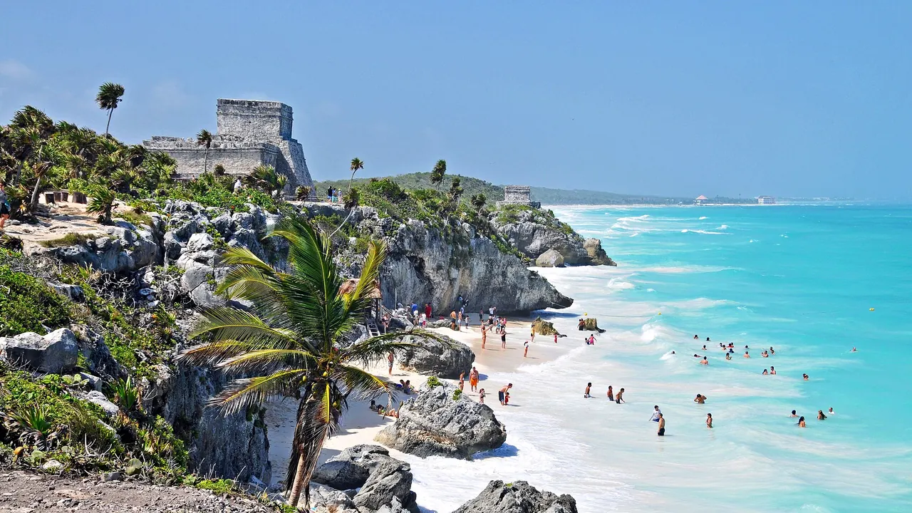
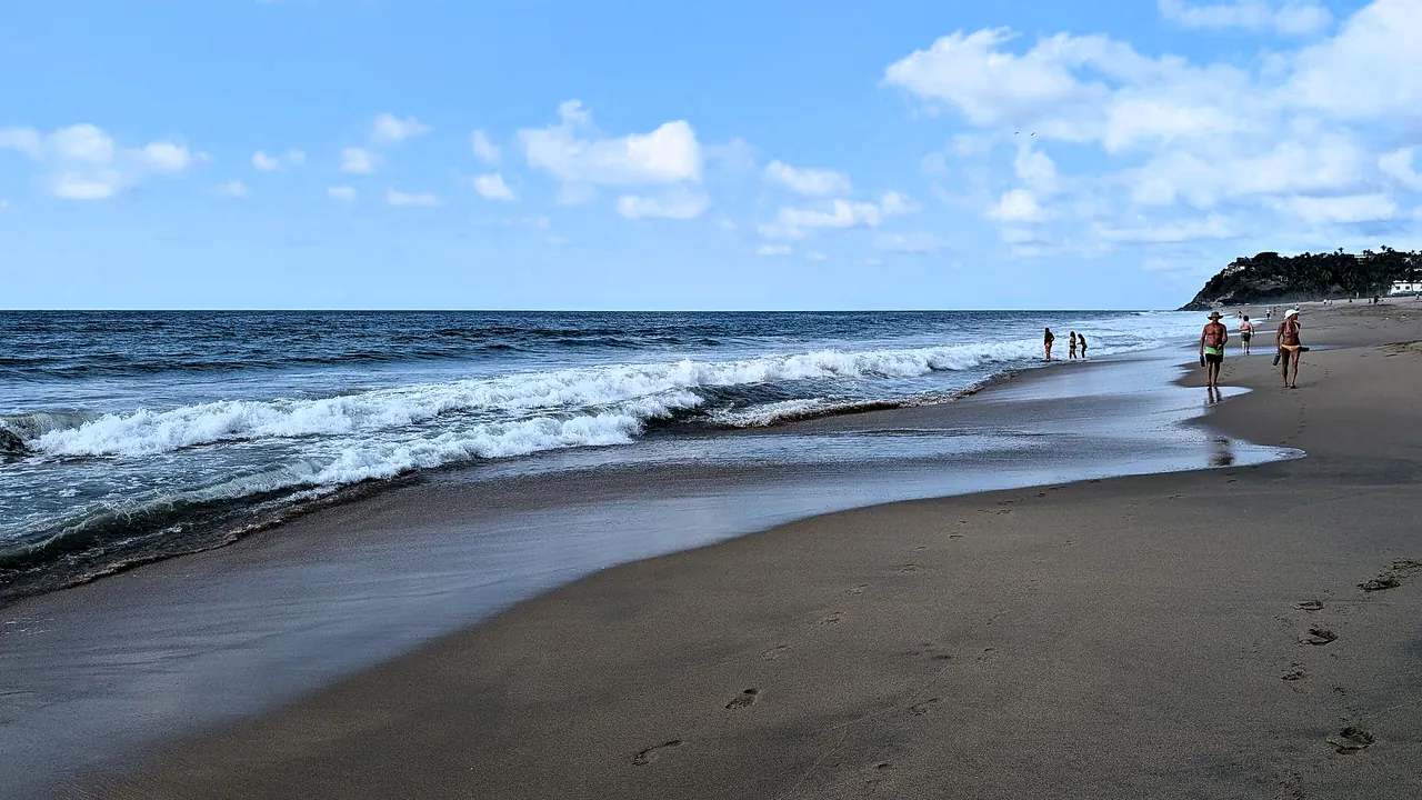
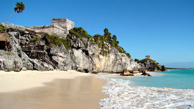
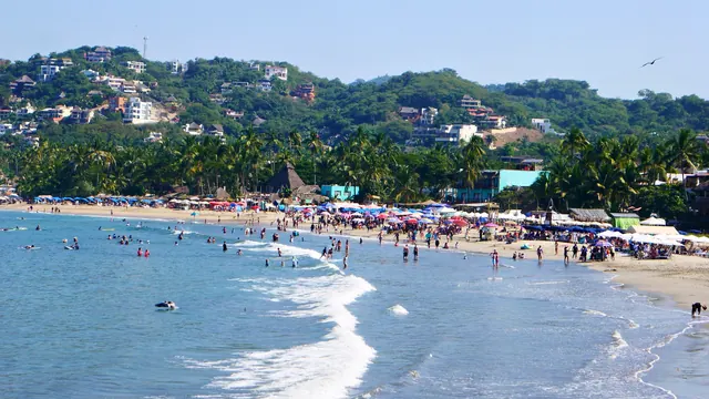
Photos: Riviera Maya by Dennis G. Jarvis, CC BY-SA 2.0, cropped; Riviera Nayarit by গীতাশ্ৰী গগৈ আপ্তে, CC BY-SA 4.0, cropped.
Riviera Maya or Riviera Nayarit?
Our verdict in twelve categories, each scored against the same fixed benchmark cities, and the climate month by month, so you can choose for your trip.
Choose Riviera Maya for
- nightlife
- culture and sights
- wellness
Riviera Maya is the stronger choice for most beach trips. The Caribbean water stays warm all year, the white sand runs almost unbroken down the coast, and a lot happens away from the beach too: cenotes and reef diving, Maya ruins at Tulum and Coba, Playa del Carmen's late bars and Tulum's yoga shalas and jungle parties. Families, divers and anyone who wants a full programme of things to do get the most from it, as long as they accept the higher costs and the risk of seaweed in spring and summer.
Choose Riviera Nayarit for
- prices
- food and drink
For a quieter Pacific stay, Riviera Nayarit makes more sense. It has surf breaks, humpback whales in the bay in winter and a string of small beach towns where evenings end early. It suits surfers, couples and travellers watching their spending, who can base themselves in Bucerías or Lo de Marcos and eat grilled fish at beach shacks. It gives up the culture, the nightlife and the ease of getting around, and for those it relies on nearby Puerto Vallarta.
Scoreboard
Twelve categories on one fixed scale from 0 to 100. The shaded stretch is the gap between the two.
Your match
Pick a travel style or drag the sliders, and both match scores follow your weighting.
Wins on nightlife and culture and sights with your weighting.
Wins on prices and food and drink with your weighting.
What matters to you?
Category by category
What the scores mean for a trip.
Beaches & swimming
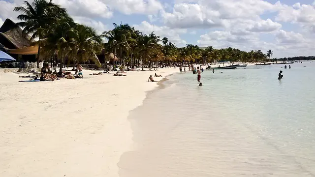
Both coasts are made for beach days, but the Caribbean side has the edge. Riviera Maya has more than 100km of white sand and clear water that stays warm all year. It ranges from Playa del Carmen's busy town beaches to the turtle bays of Akumal and Xpu-Ha, which are sheltered by the reef, and the coves below Tulum's ruins. Its one real drawback is sargassum seaweed, which in some years fouls public beaches from spring into summer.
Riviera Nayarit's strength is variety on a different sea. There are long, shallow beaches on the calm northern shore of Banderas Bay, surf-town beaches at Sayulita and San Pancho, and quiet coves at Chacala and Guayabitos. In the main winter season the water is cooler, and on the exposed Pacific stretches swimmers need to watch the flags for rip currents.
Food & drink
The two eat about equally well, but the food is different. On the Riviera Maya the cooking is Yucatecan: cochinita pibil, sopa de lima and panuchos at taquerias a few streets back from Quinta Avenida and in Tulum town. Tulum's beach road adds a more polished tier of wood-fired restaurants.
Nayarit's cooking is almost entirely about the sea. Pescado zarandeado grilled over coals, aguachile and shrimp tamales are best eaten at shacks on the sand or in Bucerías and La Cruz. On both coasts, guests who stay at an all-inclusive buffet miss the best of it.
Culture & sights
Neither coast has a historic town centre, but Riviera Maya has far more to see. Its Maya sites are real outings: Tulum's walled city on the cliff, Coba's tall pyramids linked by raised jungle roads, and smaller ruins at Muyil and on Cozumel.
Riviera Nayarit has a few scattered sights. There are the hilltop fort and church ruins at San Blas, at the far northern end, and the Altavista petroglyphs, still sacred to the Huichol. On the Pacific side, culture is a single afternoon out rather than part of the plan.
Nightlife
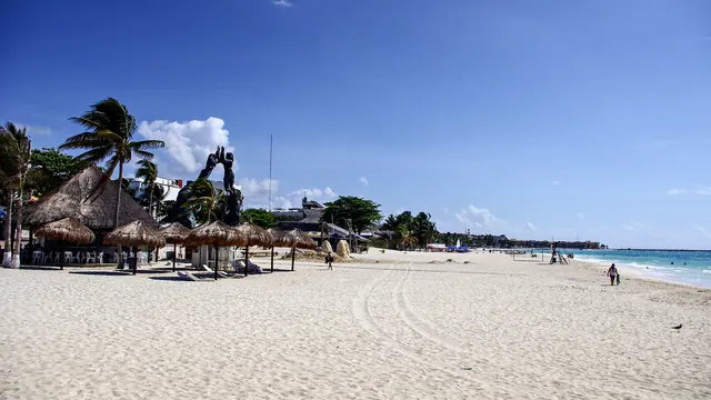
After dark the two coasts are very different. Riviera Maya has two real nightlife towns: Playa del Carmen, where the bars and clubs around Calle 12 run into the early hours, and Tulum, known for electronic music and DJ nights in jungle clearings and beach clubs.
Riviera Nayarit's evenings are mostly quiet. Sayulita's plaza and its mezcal bars stay sociable through the winter, and Bucerías has some music on the seafront, but anyone who wants a club takes a taxi down to Puerto Vallarta.
Nature & outdoors
Both are excellent outdoors, in very different ways. Riviera Maya's best scenery is underwater: cenotes such as Dos Ojos and Gran Cenote lead into vast flooded caves, the Mesoamerican Reef runs offshore, and Cozumel's walls are famous drift dives. The land itself is flat, though, with no viewpoints or hill walks.
Riviera Nayarit has height and big marine life. Jungle-covered foothills of the Sierra Madre rise behind the coast, humpback whales calve in Banderas Bay from December to March, and the Marietas Islands are a seabird park. Further north, the mangroves at La Tovara are among the best birdwatching on the Pacific coast. Divers should choose the Caribbean, while whale watchers and hill walkers will prefer the Pacific.
Day trips
Riviera Maya has the one outstanding day out. Chichen Itza, the most famous Maya city on the peninsula, is usually paired with colonial Valladolid and the cenote in the middle of town. It makes a long but memorable day inland, best started early. Ek Balam, near Valladolid, offers a quieter version of the same trip, with its finely carved stucco temple. For something shorter, the ferry crosses to Cozumel and boats from Cancun go to Isla Mujeres.
Riviera Nayarit's outings are gentler and mostly along the coast. Puerto Vallarta has its malecón and cobbled old town, boats go from there to Yelapa, a village with no road, and the beach villages along Highway 200 are easy to hop between. The former silver-mining town of San Sebastián del Oeste is a pleasant mountain drive, but nothing here compares with a great Maya city.
Good for families
For children, the Caribbean coast offers more. Besides resorts with kids' clubs, Riviera Maya has a string of eco-parks with underground rivers, zip lines and evening shows. Children can snorkel with turtles in Akumal's calm bay, and the cenotes and the short ruins at Tulum and Coba excite older children.
Riviera Nayarit works well for a simpler resort stay in Nuevo Vallarta, on wide sand that shelves gently into the bay, with a water park nearby. Whale trips and turtle releases are the highlights. There are no big attractions beyond that, and the surf beaches further north are not suitable for small children.
Getting around
Riviera Maya is the easier coast to travel along. Its single flat highway is served by long-distance buses and by shared colectivo vans that stop on request at beaches and cenote turnoffs. Bicycles link Tulum's town, beach road and ruins, although taxis there cost far more than the short distances suggest.
On the Pacific side, the airport sits right at the southern end of Riviera Nayarit, so Nuevo Vallarta is minutes away. Once you arrive, each village is easy to explore on foot, if cobbled and hilly, but only the road links them. That means local buses, taxis and a highway that winds slowly through the hills, and a hire car makes the northern beaches and San Blas much easier to reach.
Shopping & style
Riviera Maya's shopping is concentrated on one long pedestrian street, Playa del Carmen's Quinta Avenida, with silver, Talavera pottery, tequila and beachwear among the repetitive souvenir stock. Tulum adds small boutiques of linen, woven baskets and hammocks, so there is more to browse even if little of it is luxury.
Nayarit's best buy is something you won't find on the Caribbean side: the beadwork and yarn paintings of the Huichol, often sold by the artisans themselves. Add Sayulita's surf shops and the dry-season market at La Cruz, and that is most of it. Anything more means a trip to Puerto Vallarta.
Affordability
Riviera Nayarit is the cheaper of the two, provided you choose your base with care. Punta de Mita is a luxury enclave, but Bucerías, Rincón de Guayabitos and San Blas cater mainly to Mexican visitors, with modest guesthouses, and beach-shack meals are cheap all along the coast.
On the Riviera Maya, prices are set for international visitors almost everywhere. Tulum is as expensive as many European resorts, and diving, eco-parks and cenote fees all add to the bill. Travellers on a budget do best in Playa del Carmen or Puerto Morelos, staying a few blocks back from the sea.
Live music & performing arts
Neither coast has theatre, opera or a concert hall, so both suit travellers who are not planning evenings around a stage. Riviera Maya offers a bit more in the way of shows: the eco-parks stage large evening spectacles of Maya ball games and folk dance, and bars in Playa del Carmen and Tulum have live bands. In Nayarit it is mostly acoustic sets in Sayulita, mariachi in the plazas at weekends and the occasional resort dance show.
Wellness & relaxation
Riviera Maya is the more complete wellness destination. Tulum has many jungle yoga shalas, breathwork and sound-healing sessions, and palm-thatched spas along the beach road. The large resorts nearby have some of Mexico's biggest spas, with full hydrotherapy circuits, and a swim in a cool cenote is a restorative treat of its own.
Riviera Nayarit offers a smaller and calmer version. San Pancho and Sayulita have open-air studios and week-long yoga retreats, and the Punta de Mita resorts have spas on headlands above the sea. Temazcal sweat lodges are offered on both coasts. Here the main appeal is the unhurried pace rather than the range of treatments.
When should you go?
Pick your month. The climate figures are measured averages, not a forecast.
Riviera Maya in July
Riviera Nayarit in July
Daytime high, °C
Rainfall in the month, mm
Where the figures come from
Riviera Maya has no weather station within reach, so its figures come from a gridded climate model rather than a measured record, and read a broad area rather than one spot.
Riviera Nayarit has no weather station within reach, so its figures come from a gridded climate model rather than a measured record, and read a broad area rather than one spot.
Temperature and rainfall are climate normals, averaged over the years shown. Riviera Maya: 2001-2020 normals, NASA POWER reanalysis grid, no weather station within 90 km. Riviera Nayarit: 2001-2020 normals, NASA POWER reanalysis grid, no weather station within 90 km.
These figures are measured around the main resort areas. Riviera Maya is warm in every month, with daytime highs in the high 20s and a Caribbean sea that never drops below 27°C, so the beach works all year. February to April is the driest stretch. The rains arrive in May and climb quickly: June, at about 177mm, is actually wetter than September. July and August ease off a little, the rain builds again in September, and October is the wettest month of all, at about 224mm. The heat and humidity stay high throughout.
Riviera Nayarit has sharper seasons. From November to May it is almost rainless, and April is completely dry. This is the best time for walking the villages and the inland trails, although in March the sea cools to about 24°C, noticeably fresher than the Caribbean. The rains start in June and are heavy from July to September, reaching about 384mm in August. The sea is warmest then, but storms and humidity make it the weaker time to go. Across the year, Nayarit has the drier winter and Riviera Maya the more even climate.
Which traveller are you?
For a food and nightlife trip, Riviera Maya is the better pick. The food on both coasts is about equally good, but Playa del Carmen's bars and clubs stay open well past 3am, and Tulum adds DJ nights in the jungle. In Nayarit, most evenings end at a beach bar in Sayulita.
On a trip on a tight budget, Riviera Nayarit makes the money last longer. Its pleasures are mostly simple ones: a day on the sand, a local bus to the next village, grilled fish for lunch. On the Caribbean side, much of what makes the coast special lies underwater or inland and is reached on paid outings.
Surfers should choose Riviera Nayarit without hesitation. Beyond Punta de Mita the coast faces the open Pacific, and there are breaks for every level at Punta de Mita and Sayulita. Riviera Maya's reef shelters its shore, which gives calm water for snorkelling but no surf worth planning a trip around.
Before you go
| Measure | Riviera Maya | Riviera Nayarit |
|---|---|---|
| Official language | Spanish, Nahuatl, Yucatec Maya | Spanish, Nahuatl, Yucatec Maya |
| Currency | Mexican Peso (MXN) | Mexican Peso (MXN) |
| Sockets | AB127 V, 60 Hz | AB127 V, 60 Hz |
| Driving side | Right | Right |
| Time zone | UTC-5 | UTC-6 |
| Emergency number | 911 | 911 |
| Main airport | Cancún International Airport (CUN)136 non-stop destinations | Puerto Vallarta International Airport (PVR)52 non-stop destinations |
| Public holidays this year | 9 days | 9 days |
By the numbers
| Measure | Riviera Maya | Riviera Nayarit |
|---|---|---|
| Swim season, months above 21 °C | 12 months | 12 months |
Where else could you go?
Every comparison below shares a destination with this one, so you can follow Riviera Maya or Riviera Nayarit somewhere new.
- Puerto Vallartavs Riviera Nayarit
- Cozumelvs Riviera Maya
- Cancunvs Riviera Maya
- Isla Mujeresvs Riviera Maya
- Holboxvs Riviera Maya
- Yucatanvs Riviera Maya