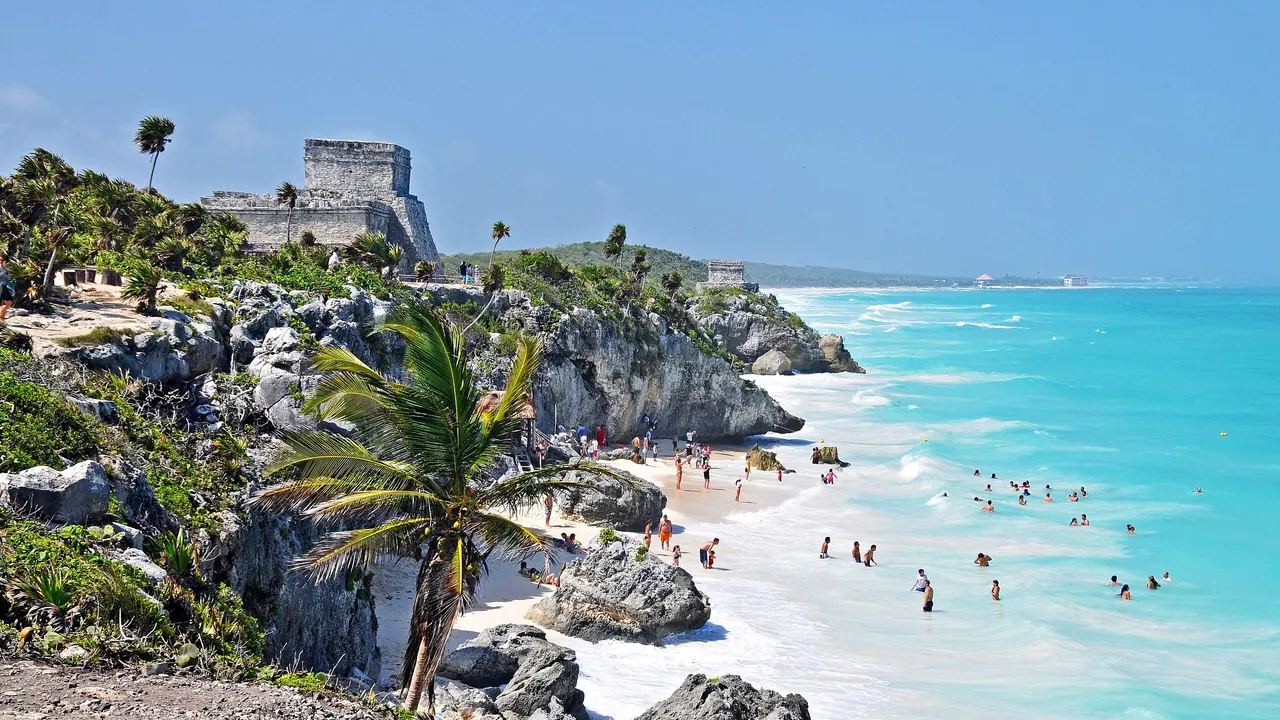
Photos: Riviera Maya by Dennis G. Jarvis, CC BY-SA 2.0, cropped.
Ambergris Caye or Riviera Maya?
Our verdict in twelve categories, each scored against the same fixed benchmark cities, and the climate month by month, so you can choose for your trip.
Choose Ambergris Caye for
- nature and the outdoors
Ambergris Caye suits travellers who want a small island where everything turns on the reef. Hol Chan's turtles and rays are a short boat ride away, dive boats head out to the atolls and the Blue Hole, the lagoon flats are good for bonefishing, and evenings end at a dock bar with a golf cart to get home. English is spoken everywhere and the scale is intimate. What you give up is good sand, sights, variety and value, and the island costs more than the Mexican coast.
Choose Riviera Maya for
- families
- wellness
- culture and sights
For almost any broader trip, the Riviera Maya is the stronger choice. Its long white beaches beat the Caye's narrow, seagrassy shore. It also has Maya ruins at Tulum and Coba, cenotes to swim in, family resorts and eco-parks, real nightlife in Playa del Carmen and Tulum, and a serious yoga and spa scene. Families, first-timers and anyone who wants to mix beach days with outings will find far more to fill a week.
Scoreboard
Twelve categories on one fixed scale from 0 to 100. The shaded stretch is the gap between the two.
Your match
Pick a travel style or drag the sliders, and both match scores follow your weighting.
Wins on nature and the outdoors with your weighting.
Wins on families and wellness with your weighting.
What matters to you?
Category by category
What the scores mean for a trip.
Beaches & swimming
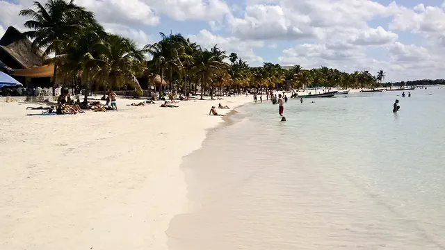
Both have the same warm turquoise water, behind the same long reef system, but the shore itself is where they part. Ambergris Caye has a thin band of sand with seagrass underfoot. People swim off the docks, wade in the still lagoon water at Secret Beach or head north for quieter sand.
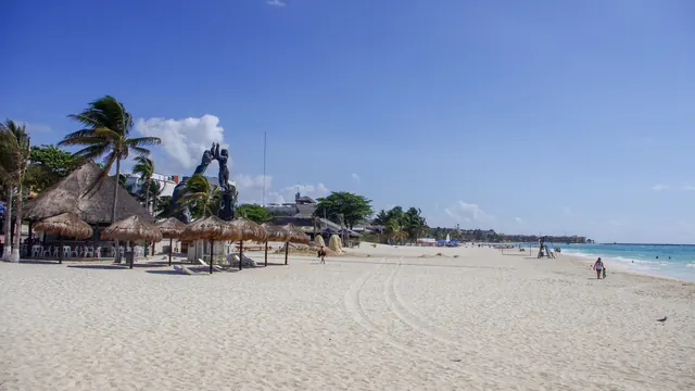
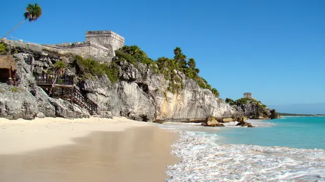
The Riviera Maya has the proper beaches: long white stretches from Puerto Morelos to Tulum, busy town beaches at Playa del Carmen, turtle bays at Akumal and the beach below Tulum's ruins. Seaweed can wash up on both in the warmer months, and on the Mexican coast winter usually gives the clearest water.
Food & drink
Neither is a place to travel to for the food, but the Riviera Maya has a regional cuisine worth seeking out. Yucatecan dishes such as cochinita pibil and sopa de lima are cooked well in the taquerias a few streets back from Playa del Carmen's Quinta Avenida and in Tulum town, and Tulum's beach road adds more ambitious kitchens.
Ambergris Caye eats well on seafood, with lobster in season, stew chicken and fry jacks for breakfast. On a small island, though, much of it is imported and aimed at visitors. In both places, the tourist strips and the all-inclusive buffets are where meals disappoint.
Culture & sights
Here the Riviera Maya pulls well ahead. Tulum's walled city on its sea cliff and the tall pyramids of Coba, linked by raised roads you can cycle along, give the coast real Maya sights, even though its towns are young and museums are scarce.
Ambergris Caye has almost nothing of this kind. San Pedro is a pretty former fishing village with a church by its small park, and Marco Gonzalez and Bacalar Chico have only low mounds. To see Maya temples from the island, you have to cross to the mainland.
Nightlife
Nights out on Ambergris Caye are barefoot affairs: sunset at an over-water bar in San Pedro, reggae and punta on the speakers, a few dance spots open past midnight and a golf cart home. It is friendly and small, and a few nights are enough to see it all.
The Riviera Maya has two proper scenes. The streets around Calle 12 in Playa del Carmen fill with clubs open until well after 3am, and Tulum is known for DJ nights in the jungle and for beach clubs, at their busiest in winter. If going out matters to you, the Mexican coast wins easily.
Nature & outdoors
Both are outstanding for nature and broadly level, but the best of it sits in different places. On Ambergris Caye it is the reef a few hundred metres offshore. Hol Chan and Shark Ray Alley are minutes away by boat, divers go out to Turneffe and the Great Blue Hole, and the mangrove flats on the lagoon side are good for fishing and kitesurfing.
The Riviera Maya looks inland and underground as much as out to sea. It has cenotes such as Dos Ojos and Gran Cenote for snorkelling and cave diving, drift dives off Cozumel, and boat trips into Sian Ka'an for dolphins and crocodiles. Neither has hills or real hiking.
Day trips
From Ambergris Caye the easy outing is Caye Caulker, a sleepier island a short water-taxi ride away. Organised trips also reach Altun Ha or, by a long river ride through the jungle, Lamanai. Beyond those, anywhere on the mainland is a long journey.
The Riviera Maya has a wider and grander choice. Chichen Itza paired with colonial Valladolid makes a long but memorable day, Ek Balam a quieter one, and ferries go to Cozumel and Isla Mujeres. Each place has one standout Maya day out, but Chichen Itza is the more celebrated site.
Good for families
The Riviera Maya is built for families in a way Ambergris Caye is not. Its resorts have kids' clubs and shallow pools, the bays at Akumal and Puerto Morelos let children snorkel among turtles, and the eco-parks offer underground rivers, zip lines and evening shows.
Ambergris Caye has flat, warm water, English everywhere and golf-cart rides, and older children love the boat trip to Hol Chan. There are no attractions made for children, though, and the seagrass shore is a poor fit for toddlers, so a resort with a pool in the north of the island is the practical base.
Getting around
Ambergris Caye is a golf-cart island. San Pedro is walkable, but the road north to the resorts is slow, some places are easiest to reach by water taxi, and there are no buses. Getting there takes a short flight or a boat ride from Belize City.
The Riviera Maya covers more ground but is easier to travel along. One straight highway is served by buses and by colectivo vans that stop at beaches and cenote turnoffs, and a hire car makes Coba and the quieter stretches simple to reach. Taxis are the weak point, especially in Tulum.
Shopping & style
Neither is a shopping destination, but the Riviera Maya gives you more to browse. Playa del Carmen's long Quinta Avenida sells silver, Talavera pottery and beachwear, and Tulum's boutiques have linen, baskets and hammocks.
On Ambergris Caye, Front Street fills an afternoon at most, with hot sauce, Belizean coffee and chocolate, rum, hardwood bowls and a few galleries.
Affordability
Both are expensive for the region, but Ambergris Caye is the steeper of the two. Nearly everything arrives by boat, which shows in the cost of meals, groceries and drinks, and golf-cart hire and boat trips push the bill up further.
The Riviera Maya can be done more cheaply if you stay a few blocks back from the sea in Playa del Carmen or Puerto Morelos, eat at taquerias and travel by colectivo. Tulum's beach hotels, though, charge as much as many European resorts. In both places winter is the costliest season.
Live music & performing arts
Neither has theatre or concerts of any weight. On Ambergris Caye, live music means a band at a beach bar, some Garifuna drumming and the summer lobster festival. The Riviera Maya adds large staged spectacles of Maya ball games and folk dance at the eco-parks, nightly resort shows and live bands in Playa del Carmen and Tulum.
Wellness & relaxation
The Riviera Maya treats rest as something to pursue. Tulum has jungle yoga shalas, retreats and sound-healing sessions, the Maya temazcal sweat lodge is a genuine local ritual, and the big resorts run some of Mexico's largest spas. Cool cenote swims add their own kind of restoration.
On Ambergris Caye, the calm comes from the setting rather than from any tradition: trade winds, palms and quiet nights north of the river bridge, with resort spas and yoga decks facing the reef. It is peaceful, but there is far less to book.
When should you go?
Pick your month. The climate figures are measured averages, not a forecast.
Ambergris Caye in July
Riviera Maya in July
Daytime high, °C
Rainfall in the month, mm
Where the figures come from
Ambergris Caye's temperatures are measured 56 km from the centre, at Belize / Phillip Goldston Intl. Airport.
Ambergris Caye has no rain gauge within 25 km of the centre, so its rainfall comes from a gridded climate dataset read at the destination rather than from a gauge further away.
Riviera Maya has no weather station within reach, so its figures come from a gridded climate model rather than a measured record, and read a broad area rather than one spot.
Temperature and rainfall are climate normals, averaged over the years shown. Ambergris Caye: 1991-2020 normals, Belize / Phillip Goldston Intl. Airport (56.1 km from centre). Riviera Maya: 2001-2020 normals, NASA POWER reanalysis grid, no weather station within 90 km.
Both places are warm all year and the sea is warm enough to swim in every month, so the thing to plan around is rain. The dry spell runs from February to April in both. On Ambergris Caye those months bring barely 35mm of rain each and the sunniest days of the year. The Caye is also the hotter of the two, with afternoons near 32°C from May to September, which makes walking around San Pedro sticky by midday.
In both places the wet season builds from June and peaks in October, which brings well over 200mm. The Riviera Maya stays a couple of degrees cooler, at around 26°C in midwinter, so December to April is the most comfortable time for ruins and town walks. Ambergris Caye's best season is similar, though January brings more showers there than on the Mexican coast.
Which traveller are you?
On a beach and sun trip, Ambergris Caye gives you dock swims and hammocks rather than sand. Choose the Riviera Maya, and base yourself at Xpu-Ha or Puerto Morelos for quiet shores, or in Playa del Carmen to step from the beach into town.
On a family trip with young children, Ambergris Caye really suits only those old enough to snorkel. The Riviera Maya is easier. An all-inclusive between Playa del Carmen and Tulum puts meals, pools and supervised activities on site, with a hire car for outings.
For divers and snorkellers, both coasts are first-rate. Ambergris Caye wins if you want the reef right on your doorstep: Hol Chan is minutes from San Pedro, and the Blue Hole is a long day out by boat. The Riviera Maya answers with Cozumel's drift walls, Akumal's turtles and its cenote caves.
Before you go
| Measure | Ambergris Caye | Riviera Maya |
|---|---|---|
| Official language | English | Spanish, Nahuatl, Yucatec Maya |
| Currency | Belize Dollar (BZD) | Mexican Peso (MXN) |
| Sockets | ABG60 Hz | AB127 V, 60 Hz |
| Driving side | Right | Right |
| Time zone | UTC-6 | UTC-5 |
| Emergency number | 911 | 911 |
| Main airport | Philip S. W. Goldson International Airport (BZE)29 non-stop destinations | Cancún International Airport (CUN)136 non-stop destinations |
| Public holidays this year | 14 days | 9 days |
By the numbers
| Measure | Ambergris Caye | Riviera Maya |
|---|---|---|
| Population | 13,000 | - |
| People per km² | 203 | - |
| Swim season, months above 21 °C | 12 months | 12 months |
Where else could you go?
Every comparison below shares a destination with this one, so you can follow Ambergris Caye or Riviera Maya somewhere new.
- Cozumelvs Riviera Maya
- Cancunvs Riviera Maya
- Isla Mujeresvs Riviera Maya
- Holboxvs Riviera Maya
- Roatánvs Ambergris Caye
- Cozumelvs Ambergris Caye