Photos: Big Sur by Diliff, CC BY-SA 3.0, cropped; Kings Canyon by Schwaltz, CC BY-SA 3.0, cropped.
Big Sur or Kings Canyon?
Our verdict in twelve categories, each scored against the same fixed benchmark cities, and the climate month by month, so you can choose for your trip.
Choose Big Sur for
- wellness
- day trips
- food and drink
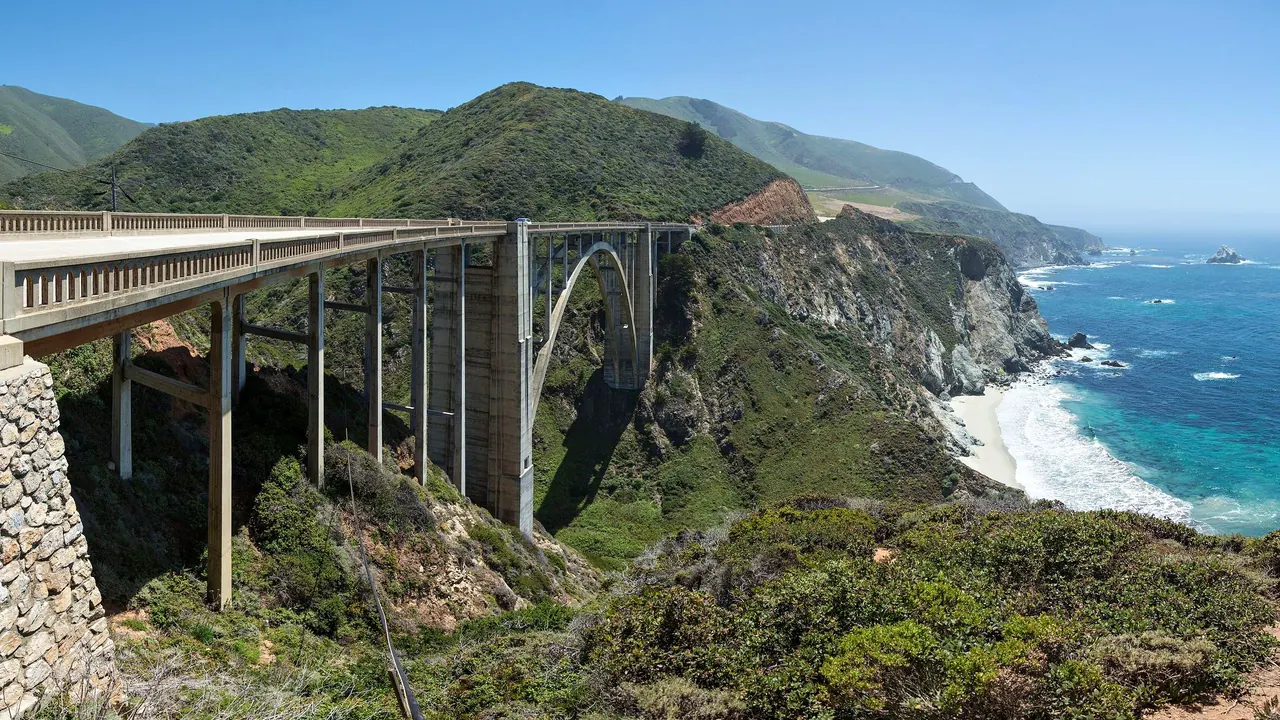
Big Sur suits travellers who want the meeting of mountains and ocean, taken slowly. It works as a coast drive with short walks to cliff viewpoints, a long lunch above the surf and a night or two in a cliff-top lodge with a spa. Carmel and Monterey are close enough for a proper dinner or a day out. It also suits anyone who can afford to pay heavily for that quiet.
Choose Kings Canyon for
- prices
- families
- getting around
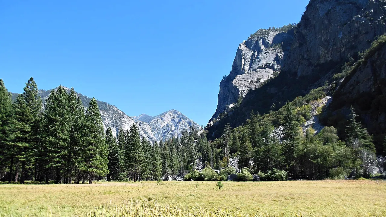
Hikers, campers and anyone who would rather spend the days on foot than at viewpoints will do better in Kings Canyon. The giant sequoias of Grant Grove, the granite walls of the Kings River canyon and the trails into the High Sierra make it a mountain trip. With a tent and your own food it is far cheaper, and the short trails suit families who camp. In return you give up almost everything else: there are no outings, no spas and nothing to eat beyond lodge grills.
Scoreboard
Twelve categories on one fixed scale from 0 to 100. The shaded stretch is the gap between the two.
Your match
Pick a travel style or drag the sliders, and both match scores follow your weighting.
Wins on wellness and day trips with your weighting.
Wins on prices and families with your weighting.
What matters to you?
Category by category
What the scores mean for a trip.
Beaches & swimming
Neither is a swimming destination, but Big Sur at least has a shoreline worth the stop. Pfeiffer Beach with its rock arch and purple sand, the coves at Garrapata and the sandy cove at Plaskett Creek are places to walk and sit. The cold, rough Pacific keeps everyone out of the water.
Kings Canyon has no coast, only a small sandy shore at Hume Lake and river pools such as the one at Muir Rock. Those pools are welcome for a chilly dip after a hike in late summer, but the snowmelt river is dangerous earlier in the season.
Food & drink
Big Sur's eating is sparse and expensive, but it has a respected bakery and a couple of serious dinner rooms cooking with Central Coast produce and wine, often with the ocean below. Carmel and Monterey are close enough for the big meals.
In Kings Canyon the food is fuel: lodge grills and small markets at Grant Grove and Cedar Grove, a snack bar at Hume Lake. Most people cook at camp, and the Mexican, Hmong and Armenian cooking of Fresno lies over an hour down the mountain.
Culture & sights
Big Sur has more stories to tell. Bixby Bridge's 1932 arch, guided walks up to the Point Sur Lightstation and the Henry Miller Memorial Library recall a coast that drew writers and the Beat generation.
Kings Canyon's heritage is a handful of logging and homesteading traces: Gamlin Cabin, Knapp's Cabin and the stumps of the Big Stump area. Its one symbolic site is the General Grant Tree, the Nation's Christmas Tree. Neither has museums or a town to wander.
Nightlife
Both go dark after dinner, so the choice is about the kind of evening. Big Sur has a few lodge bars and a roadside tavern for a drink with the sunset, though the unlit hairpin road home discourages a second round. In Kings Canyon the evening is a campfire under the sequoias and a sky full of stars, with a drink at the lodge table at most.
Nature & outdoors
Both are among the great landscapes of California, but they are different kinds of wild. Big Sur is mountains dropping straight into the Pacific, seen from about 140km of cliff road. Short walks in Point Lobos, Pfeiffer Big Sur and Julia Pfeiffer Burns lead to waterfalls and redwood canyons, with sea otters, condors, passing whales and the elephant seals at Piedras Blancas.
Kings Canyon is granite and giant trees: the sequoias of Grant Grove and a glacier-carved canyon whose floor has easy walks round Zumwalt Meadow and a longer climb to Mist Falls. It is also the better base for serious backpacking, with the Rae Lakes Loop and the John Muir Trail climbing to passes above 3,500m.
Day trips
Big Sur is far better placed for outings. To the north are Carmel's cottages and mission, Monterey's aquarium and Cannery Row, and the Carmel Valley wineries. To the south are Hearst Castle and the village of Cambria, though most people pick the end nearest their bed.
Kings Canyon offers little beyond Fresno's hand-dug Forestiere Underground Gardens and the foothill town of Three Rivers. Yosemite is too far for a comfortable day, so visitors stay in the mountains.
Good for families
Kings Canyon is the easier choice for camping families. The paved loop round the General Grant Tree, the Zumwalt Meadow boardwalk and the short path to Roaring River Falls all suit small children, and the Junior Ranger badge gives them a goal. Grant Grove's cabins make a simple base, as long as children are kept well clear of the Kings River.
Big Sur has redwood campgrounds with a creek to paddle in, and otters and elephant seals to watch. Its unfenced cliffs and cold surf call for constant watching, though, and many families base themselves in Monterey instead.
Getting around
Both need a car and plenty of patience on winding roads. Big Sur is one long line along Highway 1, slowed by summer traffic and photo stops and cut by landslides after wet winters. A sparse bus from Monterey is the only alternative.
Kings Canyon has no public transport at all and a long approach from Fresno. Its canyon road closes for the winter. Once there, though, the lodges and campgrounds at Grant Grove and Cedar Grove sit within walking distance of the trailheads.
Shopping & style
There is next to nothing to buy in either. Big Sur's roadside stops do run to a couple of galleries selling local art and jewellery, with Carmel nearby for real browsing. In Kings Canyon the shops sell sequoia souvenirs, books at the visitor centre and firewood.
Affordability
Kings Canyon is much cheaper. One vehicle pass covers it and Sequoia National Park, and campers who bring their own food spend little, though the lodges and markets inside the park charge mountain prices.
Big Sur is among the most expensive places to stay in the country, and even simple motels and cabins charge luxury rates. Fuel and supplies carry a premium too. Campgrounds are the only real escape and fill months ahead for summer, so many visitors sleep in Monterey or San Simeon and drive in.
Live music & performing arts
Big Sur has a little more to attend. The Henry Miller Memorial Library holds concerts, screenings and readings under the redwoods in the warmer months, and Monterey's jazz festival and Carmel's Bach festival lie an hour or more north. In Kings Canyon the only programme is a summer ranger talk at a campground amphitheatre.
Wellness & relaxation
Big Sur has long been a retreat coast. Esalen's stone baths are fed by hot springs above the surf and are reached through its workshops and stays. Cliff-top resorts offer massage, yoga and ocean-facing tubs, and poor phone signal and dark nights slow everyone down.
Kings Canyon gives you the quiet without the treatments. Mornings in Grant Grove are still, and evenings at Cedar Grove pass to the sound of the river. There are no spas, baths or hot springs to soak in.
When should you go?
Pick your month. The climate figures are measured averages, not a forecast.
Big Sur in July
Kings Canyon in July
Daytime high, °C
Rainfall in the month, mm
Where the figures come from
Big Sur's temperatures are measured 42 km from the centre, at Monterey / Pacific Grove Acres.
Big Sur has no rain gauge within 25 km of the centre, so its rainfall comes from a gridded climate dataset read at the destination rather than from a gauge further away.
Kings Canyon has no weather station within reach, so its figures come from a gridded climate model rather than a measured record, and read a broad area rather than one spot.
Temperature and rainfall are climate normals, averaged over the years shown. Big Sur: 1991-2020 normals, Monterey / Pacific Grove Acres (41.9 km from centre). Kings Canyon: 2001-2020 normals, NASA POWER reanalysis grid, no weather station within 90 km.
Big Sur's coast stays mild all year, with daytime highs between the high teens and about 23°C. The real divide is rain. From November to March the coast is wet, with around 205mm in December, and winter storms bring the landslides that close parts of the road. From May to September it is almost dry, and September and October are the clearest and warmest weeks. The sea never gets above about 15°C, so no month is a swimming month.
Kings Canyon has a far sharper seasonal swing at the point where the figures are taken. Summer afternoons reach about 30°C in July, warm for long climbs on exposed trails, while winter highs fall to around 8°C and snow closes the canyon road. June to September is the dry, open season for hiking. Late spring and early autumn are cooler and better for walking, and winter leaves Grant Grove to snowshoers. The two places overlap best in late summer and early autumn, when both are dry and open.
Which traveller are you?
On a relaxing and wellness trip, Big Sur is the clear choice. The coast has a long tradition as a place of retreat, with treatments and hot soaks that look out over the Pacific. Kings Canyon offers silence among the trees but no pampering.
For a trip on a tight budget, Kings Canyon is far easier on the wallet. A tent and food brought up from the valley keep a week of mountain walking cheap. In Big Sur nearly every bed is expensive, so on a small budget it works best as a day's drive.
On a family trip with young children, Kings Canyon has the edge. Short, level walks start close to where you sleep, and once you arrive the giant trees are on the doorstep. Big Sur's best moments for children are spread along a long, twisting road.
Before you go
| Measure | Big Sur | Kings Canyon |
|---|---|---|
| Currency | US Dollar (USD) | US Dollar (USD) |
| Sockets | AB120 V, 60 Hz | AB120 V, 60 Hz |
| Driving side | Right | Right |
| Time zone | UTC-8, UTC-7 in summer | UTC-8, UTC-7 in summer |
| Emergency number | 911 | 911 |
| Main airport | Monterey Regional Airport (MRY)11 non-stop destinations | Fresno Yosemite International Airport (FAT)15 non-stop destinations |
| Public holidays this year | 13 days | 13 days |
By the numbers
| Measure | Big Sur | Kings Canyon |
|---|---|---|
| Swim season, months above 21 °C | None | - |
Where else could you go?
Every comparison below shares a destination with this one, so you can follow Big Sur or Kings Canyon somewhere new.
- Sequoiavs Kings Canyon
- Carmel-by-the-Seavs Big Sur
- Montereyvs Big Sur
- Yosemitevs Kings Canyon
- Death Valleyvs Kings Canyon
- Napa Valleyvs Big Sur