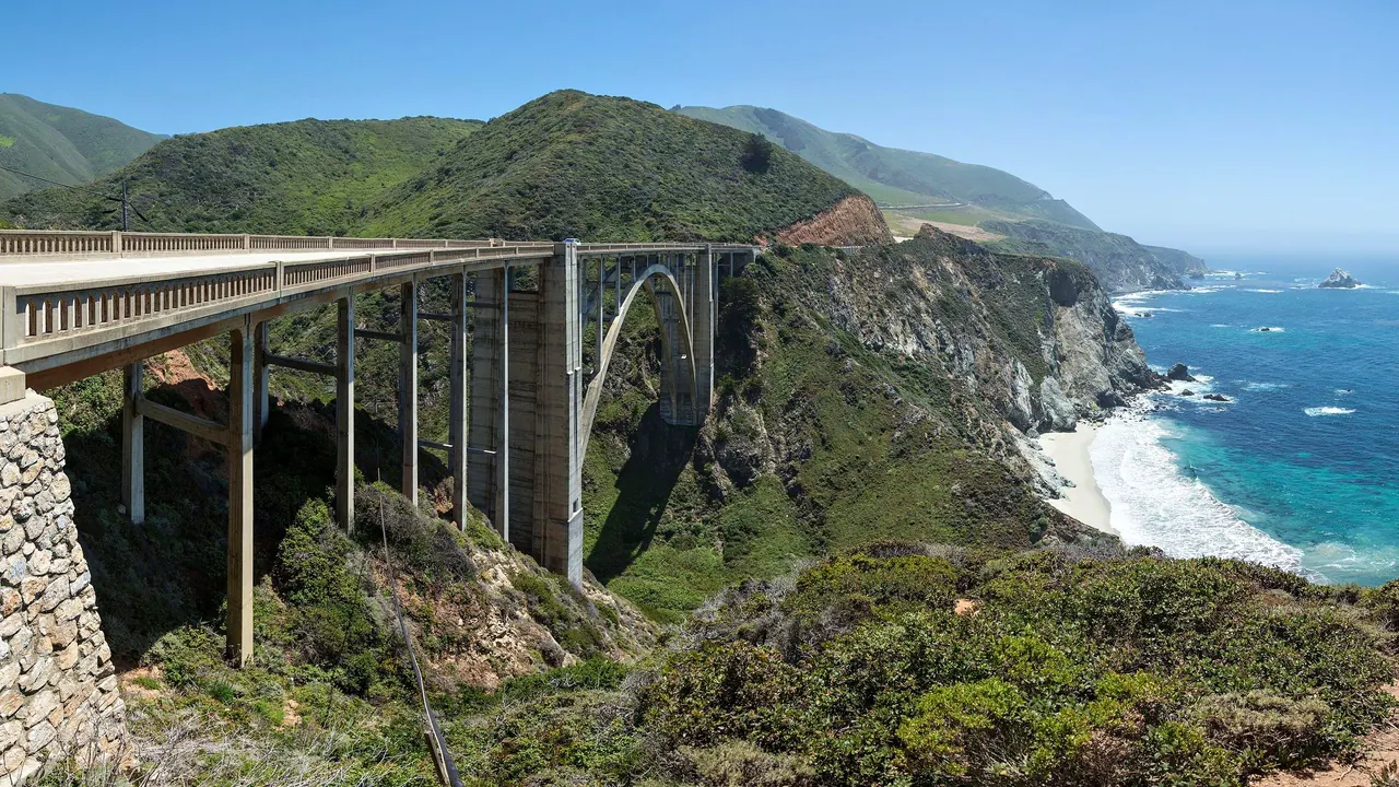
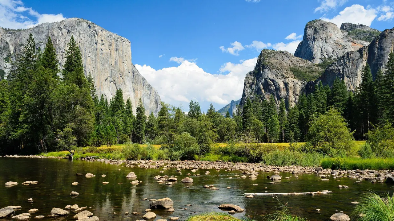
Photos: Big Sur by Diliff, CC BY-SA 3.0, cropped; Yosemite by King of Hearts, CC BY-SA 3.0, cropped.
Big Sur or Yosemite?
Our verdict in twelve categories, each scored against the same fixed benchmark cities, and the climate month by month, so you can choose for your trip.
Choose Big Sur for
- wellness
- day trips
- food and drink
Choose Big Sur for a slow, scenic stay on the edge of the Pacific, where the point is the view from a cliff-top room, a long lunch above the surf and a few days of real quiet. It suits couples and travellers who want a spa, the hot-spring baths at Esalen or simply an evening with no phone signal. It also works as one stretch of a longer California road trip, with Carmel and Monterey at one end and Hearst Castle at the other. Expect to pay heavily for it.
Choose Yosemite for
- prices
- families
- getting around
Yosemite is the stronger pick for travellers who want to be on their feet all day. The granite walls, waterfalls and long trails of the Valley, the giant sequoias and the summer high country give more to do than the coast's viewpoints. It is easier with children, cheaper if you land a campsite, and the Valley can even be reached without a car. What you give up is comfort: lodge food, summer crowds and very little to do after dark.
Scoreboard
Twelve categories on one fixed scale from 0 to 100. The shaded stretch is the gap between the two.
Your match
Pick a travel style or drag the sliders, and both match scores follow your weighting.
Wins on wellness and day trips with your weighting.
Wins on prices and families with your weighting.
What matters to you?
Category by category
What the scores mean for a trip.
Beaches & swimming
Neither is somewhere to plan swims, and the difference is salt water against fresh. Big Sur's shores, Pfeiffer Beach with its arch and purple sand, the Garrapata coves and Plaskett Creek, face a Pacific of about 13°C with heavy surf and rip currents, so you walk the beach and swim in a lodge pool.
Yosemite's water comes from rivers and lakes. In late summer there are calm pools and sandbars on the Merced in the Valley, the sandy, ice-cold shore of Tenaya Lake, and warmer Bass Lake just outside the park. Avoid the rivers in spring, when they run fast and dangerous.
Food & drink
Big Sur eats a little better, mostly because of where the tables are. It has a respected bakery, a couple of serious dinner rooms cooking with Central Coast produce and wine, and cliff-side terraces for a long lunch, though choice is thin and keen eaters still drive to Carmel or Monterey.
Yosemite's food is fuel for the trail: lodge cafeterias, pizza counters and general stores, with the historic dining room in the Valley as the one special setting. Mariposa and Groveland add diners, barbecue and Mexican cooking, and many visitors find a campsite meal or a packed picnic the best of the day.
Culture & sights
Both are thin on man-made sights, and what each has is different in kind. Big Sur's heritage is a handful of stops along the road: Bixby Bridge, the Point Sur Lightstation on its volcanic rock, and the Henry Miller Memorial Library, which carries the coast's story as a refuge for writers and the Beats.
Yosemite's is rustic park history. There is the timber-and-stone grand hotel, the Yosemite Museum's displays on Ahwahneechee Miwok life, Ansel Adams's conservation photography, and the stagecoach-era Pioneer History Center at Wawona. In either place an hour or two covers each sight.
Nightlife
Both go dark early, and neither is a place for going out. On the coast a lodge bar or the roadside tavern is as far as it goes, since nobody wants to drive Highway 1 at night after a drink. Yosemite offers a lodge lounge, a ranger talk or a brewpub in a gateway town. In both, the stars are the real evening show, and Monterey is the nearest proper night out from Big Sur.
Nature & outdoors
These are two of California's great landscapes, and Yosemite has the edge for sheer scale and range of activity. Granite walls rise about 1,000m from the Valley floor, the falls roar in spring, and there are classic hikes up the Mist Trail and Half Dome, El Capitan's big walls, the sequoias of Mariposa Grove and the summer high country of Tuolumne Meadows. Winter adds gentle skiing at Badger Pass.
Big Sur's drama is mountains meeting sea: 140km of cliffs, redwood canyons and short walks to headland viewpoints at Point Lobos and Julia Pfeiffer Burns. It also offers marine wildlife Yosemite cannot, with sea otters, passing grey whales and the elephant seals near Piedras Blancas, plus condors overhead.
Day trips
Big Sur has more within reach beyond its own boundaries. Carmel's galleries and mission, Monterey's aquarium and Cannery Row, and the Carmel Valley wineries lie at the northern end. Hearst Castle and Cambria lie at the southern end, though the slow road means picking one end rather than both.
From Yosemite most days are spent inside the park. The Gold Country to the west makes a good change, with Columbia's preserved main street, Jamestown's steam railway yard and the wineries around Murphys. In summer only, the ghost town of Bodie lies over Tioga Pass.
Good for families
Yosemite is the easier choice with children. The flat Valley floor has paved cycle paths, a short walk to Lower Yosemite Fall, meadows and shallow river edges in late summer, and the Junior Ranger programme. Bears, cliffs and spring rivers still call for close supervision.
Big Sur works only for families who camp. The redwood campgrounds by the Big Sur River and the otters and elephant seals are real highlights, but the sea is unsafe for play, viewpoints are unfenced and the hairpins upset young stomachs.
Getting around
Yosemite is easier to get around, at least in the Valley. Free shuttles and bike paths link the lodges and trailheads, and a regional bus from the train station at Merced makes a car-free stay possible. Glacier Point, Mariposa Grove and Tuolumne still need a car, and Tioga Road shuts through the snowy months.
Big Sur is one narrow road, Highway 1, and nothing works without a car. There is little petrol, phone signal is patchy, and summer traffic stops for photographs. After a wet winter a landslide can turn a short drive into an inland detour of several hours.
Shopping & style
Neither is a shopping destination, and what little there is differs. Big Sur's roadside stops sell crafts, jewellery and local art, with Carmel nearby for proper browsing. Yosemite's park stores lean to maps, books and outdoor basics, with a Valley gallery of fine-art landscape prints and gateway-town outfitters for forgotten gear.
Affordability
Both are expensive in season, but Yosemite leaves more room to save. Its campsites are very cheap if you can get one, the shuttles and trails cost nothing once you are inside, and winter or a base down in the foothills cuts costs further.
Big Sur sits among the costliest stays in the United States. Even modest cabins charge city-hotel rates, everything trucked in along the one road carries a premium, and park parking fees add up. Campsites booked months ahead, or sleeping in Monterey or San Simeon, are the main ways to save.
Live music & performing arts
Big Sur has slightly more to attend, though neither is worth planning a trip around. The Henry Miller Memorial Library holds outdoor concerts, readings and film nights under the redwoods in the warmer months, and Monterey's jazz festival and Carmel's Bach festival are an hour or more north.
In Yosemite the evening programme is ranger campfire talks and the occasional one-person historical show. For a stage you have to drive down to the small repertory theatre in Sonora.
Wellness & relaxation
This is where the two part company most clearly. Big Sur is a long-established retreat coast. Esalen's hot-spring baths sit on a ledge above the surf, the cliff resorts run full spas with yoga and ocean-facing tubs, and the lack of signal and town makes slowing down almost unavoidable, though all of it is booked ahead and costly.
Yosemite restores you the way wild country does, with a couple of resort spas near the southern entrance and summer hot springs at Bridgeport and Mammoth beyond Tioga Pass. The Valley in July is too busy to feel like a retreat, so look for quiet in winter or up in the high country.
When should you go?
Pick your month. The climate figures are measured averages, not a forecast.
Big Sur in July
Yosemite in July
Daytime high, °C
Rainfall in the month, mm
Where the figures come from
Big Sur's temperatures are measured 42 km from the centre, at Monterey / Pacific Grove Acres.
Big Sur has no rain gauge within 25 km of the centre, so its rainfall comes from a gridded climate dataset read at the destination rather than from a gauge further away.
Yosemite has no weather station within reach, so its figures come from a gridded climate model rather than a measured record, and read a broad area rather than one spot.
Temperature and rainfall are climate normals, averaged over the years shown. Big Sur: 1991-2020 normals, Monterey / Pacific Grove Acres (41.9 km from centre). Yosemite: 1991-2020 normals, TerraClimate 4 km grid at the town, no weather station within 90 km.
Big Sur barely changes temperature through the year. Days stay mild, from the high teens in winter to about 23°C from August to October. What changes is the rain: the coast is almost dry from May to September, then wet from November to March, peaking at around 205mm in December, when storms bring the landslides that close the road. Early autumn is the sweet spot, warm, dry and often clearer than the foggy summer. The sea never gets above about 15°C, so swimming is never really on.
Yosemite has proper seasons. In the Valley, winter highs sit around 8°C, with snow and rain from November to March, and July and August reach 28°C, hot for a long climb but ideal for the high country once Tioga Road opens. Late spring brings the strongest waterfalls and September brings settled hiking weather, so Yosemite is best from May to early October. Big Sur is the gentler choice if you are going in winter, as long as you check that the road is open.
Which traveller are you?
On a relaxing and wellness trip, Big Sur is the clear choice. The Esalen hot springs, cliff-top spas with ocean-facing tubs and nights of real darkness make it a coast built for slowing down. Summer in Yosemite Valley feels far busier.
On a family trip with children, Yosemite works better. The flat Valley floor has cycle paths, easy falls walks, Junior Ranger activities and sequoias to gaze up at. Big Sur offers unfenced cliffs, a cold, rough sea and a winding road that brings on car sickness.
For a trip on a tight budget, Yosemite is the more forgiving of the two. Its campsites are very cheap, the Valley shuttles and trails cost nothing, and winter rates drop. Big Sur ranks among the dearest places to stay in the country, and supplies and fuel are dear too.
Before you go
| Measure | Big Sur | Yosemite |
|---|---|---|
| Currency | US Dollar (USD) | US Dollar (USD) |
| Sockets | AB120 V, 60 Hz | AB120 V, 60 Hz |
| Driving side | Right | Right |
| Time zone | UTC-8, UTC-7 in summer | UTC-8, UTC-7 in summer |
| Emergency number | 911 | 911 |
| Main airport | Monterey Regional Airport (MRY)11 non-stop destinations | Fresno Yosemite International Airport (FAT)15 non-stop destinations |
| Public holidays this year | 13 days | 13 days |
By the numbers
| Measure | Big Sur | Yosemite |
|---|---|---|
| Swim season, months above 21 °C | None | - |
Where else could you go?
Every comparison below shares a destination with this one, so you can follow Big Sur or Yosemite somewhere new.
- Carmel-by-the-Seavs Big Sur
- Montereyvs Big Sur
- Kings Canyonvs Yosemite
- Lake Tahoevs Yosemite
- Sequoiavs Yosemite
- Napa Valleyvs Big Sur