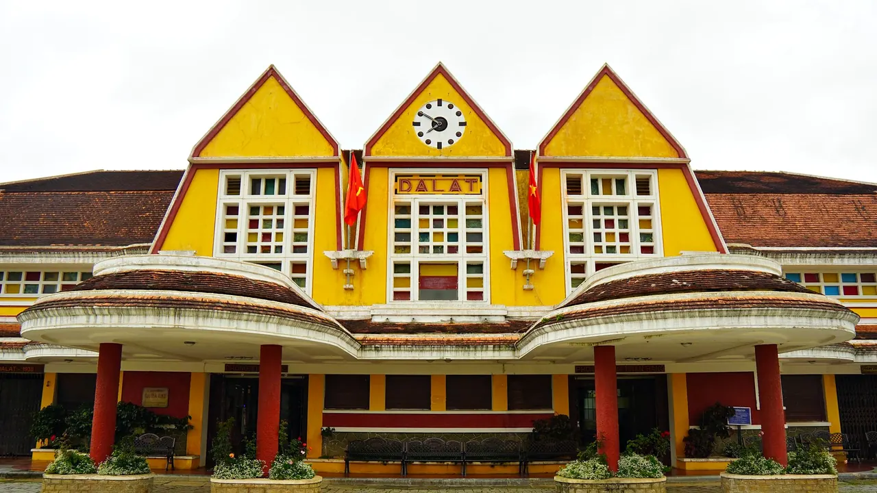

Photos: Da Lat by Pham Huynh Tuan Vy, Pexels License; Sapa by Kirandeep Singh Walia, Pexels License.
Da Lat or Sapa?
Our verdict in twelve categories, each scored against the same fixed benchmark cities, and the climate month by month, so you can choose for your trip.
Choose Da Lat for
- food and drink
- families
- culture and sights
Da Lat suits a gentler, more varied trip. It has more to eat, more sights in town, easy attractions for children and a mild climate all year, so a family, a couple wanting slow mornings over coffee among the pines, or anyone after a few relaxed days with some canyoning or mountain biking thrown in will find it the better choice.
Choose Sapa for
- nature and the outdoors
- day trips
- getting around
Sapa is for walkers. The terraced Muong Hoa valley, Fansipan and village trails starting at the edge of town make it the stronger pick for travellers who want to spend their days on foot and their nights in a homestay. Ethnic minority markets like Bac Ha add a reason to stay longer, but the food, the evenings and the in-town sights are thinner, and small children will find it hard going.
Scoreboard
Twelve categories on one fixed scale from 0 to 100. The shaded stretch is the gap between the two.
Your match
Pick a travel style or drag the sliders, and both match scores follow your weighting.
Wins on food and drink and families with your weighting.
Wins on nature and the outdoors and day trips with your weighting.
What matters to you?
Category by category
What the scores mean for a trip.
Beaches & swimming
Neither city is a place to swim, and both need a separate stretch on the coast for any sea time. The difference is distance. From Da Lat, Nha Trang or Ninh Chu Bay is a few hours down the mountain passes, so the coast fits easily into the same route. From Sapa, the nearest sea is a whole journey away, and cold streams are all there is nearby.
Food & drink
Da Lat is the better place to eat. The farms in its valleys supply avocados, artichokes and strawberries, the evening market by the central market steps is a meal in itself, and arabica grown on nearby slopes makes coffee on a terrace above the pines part of every day.
Sapa's best food is good after a long walk: salmon and sturgeon hotpot, grilled skewers by the lake, and Hmong dishes such as thang co for the adventurous. Outside that, the centre offers mostly mixed traveller menus, so the choice runs out sooner than in Da Lat.
Culture & sights
Da Lat has more to see in the town itself: French villas among the pines, the pink Domaine de Marie church, the Art Deco station, Bao Dai's Summer Palace, and odder sights like the Crazy House and the mosaic-covered Linh Phuoc pagoda.
In Sapa, the town has little beyond its stone church and a small museum. The culture lies out in the valleys, with the Black Hmong, Red Dao, Tay and Giay villages, where indigo dyeing and weaving are part of everyday life. To see that, you have to walk past the busy, partly staged villages near town.
Nightlife
Both are early-night towns, but Da Lat has a little more going on after dark. The night market keeps the centre lively into the evening, and the backpacker bars include a famously maze-like one most visitors try once. Sapa's evenings come down to a hotpot, the lakeside grills and a handful of pool-table bars, and then bed before the next day's walk.
Nature & outdoors
Sapa has the more dramatic landscape. The Muong Hoa valley's rice terraces drop away below the town, Fansipan rises to 3,143m, and you can set off on one- to three-day treks between homestays without needing transport. The views change a great deal with the seasons and the cloud.
Da Lat is gentler: pine hills, lakes, Langbiang mountain and the forests of Bidoup-Nui Ba. Its strength is organised adventure, such as canyoning at Datanla, abseiling and downhill biking through coffee farms, though greenhouse farming takes away from many of the valleys.
Day trips
Sapa offers better outings. Bac Ha's Sunday market, where Flower Hmong come to trade buffalo and textiles, is a real draw, and smaller markets like Can Cau and Coc Ly give a quieter version of the same thing.
Da Lat's mountains cut it off more. The one strong outing is the long drive down to Phan Rang for the Po Klong Garai Cham towers and pottery villages. Otherwise, it is K'Ho villages and coffee or silk farms close to town.
Good for families
Da Lat is far easier with children. Vietnamese families go there for the Valley of Love, strawberry picking, the mountain coaster and the cable car to Tuyen Lam Lake, and the mild weather means no one wilts in the heat. Steep streets and spread-out sights mean plenty of taxi rides.
Sapa suits older children who can manage a village walk and enjoy a homestay night or the Fansipan cable car. With toddlers, the slippery trails, cold rooms in winter and persistent vendors make it hard work.
Getting around
Getting around is about equally awkward in both. Each has a hilly, walkable centre with uneven pavements and no public transport worth using. In Da Lat, metered taxis and ride-hailing apps are the easy way to reach sights spread over the hills.
In Sapa, much of the getting around is done on foot along trekking trails, with motorbike taxis or a car and driver for the passes. A short mountain tram runs to the Fansipan cable car. Reaching Sapa from Hanoi is also a long road journey or an overnight train.
Shopping & style
There is little shopping in either town, but what there is differs. Da Lat's best buys are edible: dried fruit, strawberry jam, artichoke tea and local coffee beans, plus warm hats and second-hand jackets at the night market. Sapa sells textiles, such as Hmong and Dao embroidery, indigo batik and silver jewellery. Some of it is fine handwork, but you need to know how to spot machine-made copies.
Affordability
Both are very cheap by international standards, and Da Lat is a little cheaper overall, with low-cost rooms overlooking the pines and night-market dinners. Its prices rise only around Tet and the long national breaks, when Vietnamese visitors fill the rooms.
In Sapa, the hotels and cafés in the centre cost slightly more than in the lowlands, and the Fansipan cable car is the one real splurge. Guided treks and village homestays still cost little.
Live music & performing arts
Neither has a theatre or concert season, but Da Lat's evenings offer something better to listen to. Small cafés host acoustic sets of Vietnamese ballads, many of them written about the city, and the Flower Festival brings outdoor shows. In Sapa, it comes down to short Hmong and Dao pan-pipe and dance performances in the square at weekends.
Wellness & relaxation
Both are calm places to slow down, but in different ways. Da Lat offers cool, misty mornings over the lakes, long hours in cafés and a few villa resorts with proper spas. Sapa has an actual bathing tradition, the Red Dao herbal bath in wooden tubs, which is a real pleasure after a day's walking. In both towns, the quiet is found out among the trees or terraces rather than in the centre.
When should you go?
Pick your month. The climate figures are measured averages, not a forecast.
Da Lat in July
Sapa in July
Daytime high, °C
Rainfall in the month, mm
Where the figures come from
Da Lat has no weather station within reach, so its figures come from a gridded climate model rather than a measured record, and read a broad area rather than the city itself.
Sapa has no weather station within reach, so its figures come from a gridded climate model rather than a measured record, and read a broad area rather than the city itself.
Temperature and rainfall are climate normals, averaged over the years shown. Da Lat: 1991-2020 normals, TerraClimate 4 km grid at the town, no weather station within 90 km. Sapa: 1991-2020 normals, TerraClimate 4 km grid at the town, no weather station within 90 km.
Da Lat barely changes temperature through the year, with daytime highs of around 22°C to 25°C in every month, so it is never too hot or too cold for walking the streets. What changes is the rain. December to March is the dry stretch and the best time for trekking and waterfalls. From May to October the afternoons are wet, peaking at about 269mm in August, and the trails turn muddy.
Sapa has proper seasons. Winter days peak at around 15°C in January, nights are colder still and fog is common, while summer is warm but very wet, with about 433mm falling in July. The driest months are November and December, though they are chilly, and spring and autumn give the best balance for walking. September is also worth considering, when the terraces turn gold before the harvest. Neither city has a beach season, since both are far from the sea.
Which traveller are you?
For an outdoors trip, Sapa is the better choice. Multi-day treks through the rice terraces to village homestays, a climb up Fansipan, Indochina's highest peak, and trails that start right in town all beat Da Lat's more organised canyoning and biking.
On a family trip with young children, Da Lat works much better. Strawberry picking, paddle boats, the mountain coaster and the cable car keep small children busy in mild weather, while Sapa's steep, muddy trails and cold winters mostly suit older children who can walk.
For a food and nightlife trip, Da Lat gives you more. Its evening market, bánh căn, hotpot with wild greens and coffee grown on the hills beat Sapa's narrow range of grills and hotpots, and its cafés with live music give the evenings a bit more life.
Before you go
| Measure | Da Lat | Sapa |
|---|---|---|
| Official language | Vietnamese | Vietnamese |
| Currency | Dong (VND) | Dong (VND) |
| Sockets | ACFG220 V, 50 Hz | ACFG220 V, 50 Hz |
| Driving side | Right | Right |
| Time zone | UTC+7 | UTC+7 |
| Emergency number | Police 113, ambulance 115, fire 114 | Police 113, ambulance 115, fire 114 |
| Elevation | 1,500 m | 1,544 m |
| Main airport | Lien Khuong Airport (DLI)22 km from centre7 non-stop destinations | Noi Bai International Airport (HAN)238 km from centre91 non-stop destinations |
By the numbers
| Measure | Da Lat | Sapa |
|---|---|---|
| City population | 406,105 | 70,663 |
| People per km² | 1,032 | 103 |
| Museums within 10 km | 0 | 0 |
| UNESCO World Heritage sites within 50 km | 0 | 0 |
Where else could you go?
Every comparison below shares a destination with this one, so you can follow Da Lat or Sapa somewhere new.
- Nha Trangvs Da Lat
- Ho Chi Minh Cityvs Da Lat
- Hanoivs Sapa
- Luang Prabangvs Sapa
- Ha Longvs Sapa
- Phnom Penhvs Da Lat