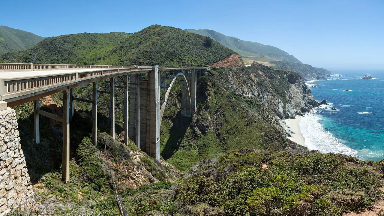
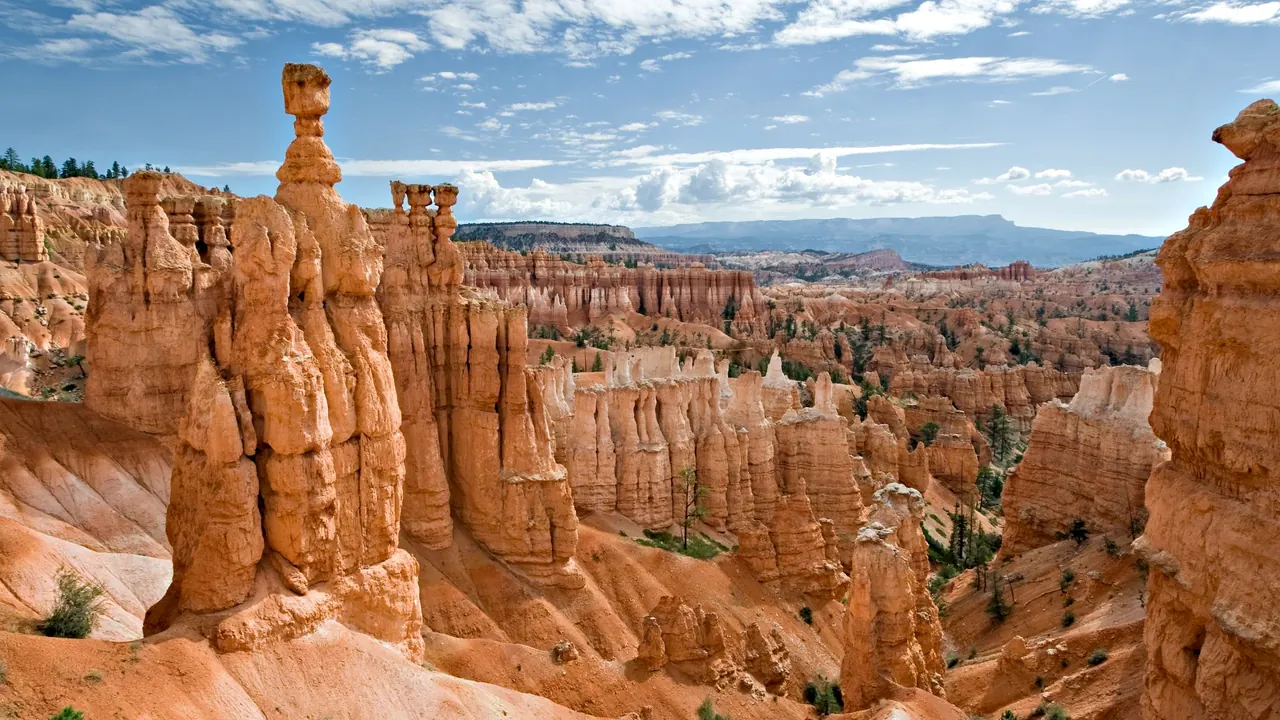
Photos: Big Sur by Diliff, CC BY-SA 3.0, cropped; Bryce Canyon by Luca Galuzzi (Lucag), CC BY-SA 2.5, cropped.
Big Sur or Bryce Canyon?
Our verdict in twelve categories, each scored against the same fixed benchmark cities, and the climate month by month, so you can choose for your trip.
Choose Big Sur for
- wellness
- day trips
- beaches
Big Sur suits travellers who want to slow down somewhere beautiful and can afford to. Think of a couple booking a cliff-top lodge or a stay at Esalen, a long lunch above the ocean, and outings to Carmel, Monterey or Hearst Castle. It is the better choice for retreat and for having real towns within reach. The price is a demanding road and some of the highest room rates in the country.
Choose Bryce Canyon for
- getting around
- prices
- families
A family that likes walking, or a road trip on a tighter budget, will find Bryce Canyon easier. Children can manage the short hoodoo trails, the park drive and summer shuttle are simple to use, and camping or the older Panguitch motels keep costs down. Expect early nights, plain food and little to do beyond the landscape, which is the reason to go.
Scoreboard
Twelve categories on one fixed scale from 0 to 100. The shaded stretch is the gap between the two.
Your match
Pick a travel style or drag the sliders, and both match scores follow your weighting.
Wins on wellness and day trips with your weighting.
Wins on getting around and prices with your weighting.
What matters to you?
Category by category
What the scores mean for a trip.
Beaches & swimming
Neither place is for swimming, but Big Sur at least has a shoreline worth visiting. Pfeiffer Beach with its rock arch and purple sand, the Garrapata coves and the sandy cove at Plaskett Creek are good for a walk and a sit. Cold water and rip currents keep you out of the sea.
Bryce Canyon is high plateau, hundreds of kilometres from any coast, and its reservoirs at Tropic and Panguitch Lake are for fishing and paddling. In both places the only real swim is in a lodge or motel pool.
Food & drink
Big Sur has the better meals, though they are few and expensive. A respected bakery and a couple of serious dinner rooms cook with Central Coast produce and wine, and the ocean view comes with the meal. Carmel and Monterey, just beyond the northern end, are close enough for a proper dinner out.
Bryce's gateway towns feed hikers ranch breakfasts, steaks, Navajo tacos and pie. The more ambitious kitchens are an evening's drive away in Escalante and Boulder, and Utah's alcohol rules limit what you can drink with dinner. Most people pack a picnic for the trail.
Culture & sights
Both are thin on heritage, and an afternoon covers either. Big Sur is slightly ahead. You can stop at Bixby Bridge, take a guided walk at the Point Sur Lightstation, and visit the Henry Miller Memorial Library, whose links to writers and the Beat generation give the coast its stories.
Bryce offers early national park architecture at its 1920s lodge, Paiute stories of the hoodoos at the visitor centre, the red-brick pioneer houses of Panguitch and the excavated Puebloan village at Boulder's Anasazi museum.
Nightlife
Evenings end early in both. Big Sur has a few lodge bars and a roadside tavern, but a dark, winding Highway 1 puts people off a second drink. Bryce's small Mormon towns have even fewer bars, and visitors go to bed early to be on the rim for sunrise. What takes the place of nightlife differs: a campfire under the redwoods on the coast, ranger-led astronomy under some of the country's darkest skies at Bryce.
Nature & outdoors
Both are outstanding, and the choice is between ocean and canyon. Big Sur is about 140km of mountains dropping into the Pacific, with redwood canyons, waterfalls and short walks to cliff viewpoints. Its wildlife is a big part of the draw: condors, sea otters, grey whales offshore and the elephant seals at Piedras Blancas. The Ventana Wilderness trails offer longer, steeper days.
Bryce is one extraordinary landscape: amphitheatres of orange and pink hoodoos at about 2,400m, which you walk down into on the Navajo Loop or Queen's Garden. Red Canyon, Kodachrome Basin and the slot canyons of Grand Staircase-Escalante are close by. In winter Bryce also offers snowshoeing and cross-country skiing on the rim, which the coast cannot.
Day trips
Big Sur has proper towns at both ends. To the north are Carmel's cottages, galleries and mission, Monterey's Cannery Row, old adobe quarter and aquarium, and the Carmel Valley wineries. To the south are Hearst Castle and Cambria. The drives are slow, so most people stick to the end they sleep nearest.
From Bryce, most outings lead to more scenery. Panguitch's pioneer main street, Kanab's Western film past and the college town of Cedar City are pleasant stops on a drive rather than places to spend a day.
Good for families
Bryce is the better choice with children, as long as they can walk some distance. The flat paved rim path between Sunrise and Sunset Points, the Junior Ranger programme, horse rides and the Queen's Garden descent fill a few days. The thin air and the climb back out do tire young legs.
Big Sur works mainly for families who camp, with creek paddling on the Big Sur River, the short McWay Falls walk and sea otters at Point Lobos. Against that are a cold, rough sea, unfenced cliffs and a twisting road that makes children carsick.
Getting around
Bryce is much simpler once you are there. The roads are quiet and well kept, the 30km scenic drive has pull-outs at every viewpoint, a summer shuttle runs to the busiest overlooks, and the Rim Trail links the main viewpoints on foot. The hard part is getting there, with the nearest large airports several hours away.
Big Sur depends on one narrow, crowded road, Highway 1, with few petrol stations and patchy phone signal. After wet winters, landslides can force detours of several hours inland, and you cannot walk from one stop to the next.
Shopping & style
Neither place is for shopping, and what differs is the souvenirs. Big Sur's roadside stops have craft shops and small galleries selling local art and jewellery, and Carmel is where people go to browse properly. At Bryce it is Western wear and camping supplies at the general store, park books and maps, and rock shops selling fossils and geodes.
Affordability
Bryce costs a good deal less. Rooms are pricey in high season and park fees add up on a road trip through several parks. Once you are inside, though, the trails, shuttle and ranger programmes cost nothing more, and campgrounds, Panguitch motels and winter stays keep the bill modest.
Big Sur is one of the most expensive places to stay in the country. Even plain motels charge what a good city hotel would, and food and petrol cost more because everything comes in by one road. To save, camp in sites booked months ahead or sleep in Monterey or San Simeon and drive in.
Live music & performing arts
There is little to attend at either, and the serious programmes are an hour or more away. Big Sur has readings, films and summer concerts under the redwoods at the Henry Miller Memorial Library, with Monterey's jazz festival and Carmel's Bach festival up the road. Near Bryce it is a summer cowboy dinner show, but the Utah Shakespeare Festival in Cedar City is worth building a theatre evening around.
Wellness & relaxation
Big Sur is one of the West's great retreat coasts. Esalen has hot-spring baths on a ledge above the surf, and the cliff-top resorts run spas with tubs facing the ocean. Poor phone signal and dark nights add to the quiet, and people come for slow, costly days of doing very little.
Bryce offers calm but not pampering: cool air, empty roads and an evening on a lodge porch under the stars. Beyond the odd hotel hot tub there is little, and days spent hiking at altitude are anything but restful.
When should you go?
Pick your month. The climate figures are measured averages, not a forecast.
Big Sur in July
Bryce Canyon in July
Daytime high, °C
Rainfall in the month, mm
Where the figures come from
Big Sur's temperatures are measured 42 km from the centre, at Monterey / Pacific Grove Acres.
Big Sur has no rain gauge within 25 km of the centre, so its rainfall comes from a gridded climate dataset read at the destination rather than from a gauge further away.
Bryce Canyon has no rain gauge within 25 km of the centre, so its rainfall comes from a gridded climate dataset read at the destination rather than from a gauge further away.
Temperature and rainfall are climate normals, averaged over the years shown. Big Sur: 1991-2020 normals, Monterey / Pacific Grove Acres (41.9 km from centre). Bryce Canyon: 2004-2020 (rainfall 1991-2020) normals, Bryce Canyon / Bryce Canyon City (3.9 km from centre).
Big Sur is mild all year, never really cold and never hot, so the weather question is rain. From November to March storms come often, with the most rain in December at about 205mm. This is also when landslides tend to close the road. From May to September it is almost completely dry, and the warmest settled weather runs from late summer into October. The sea stays at 15°C or below all year, so this is never a coast for swimming.
Bryce Canyon changes far more through the year. In winter, daytime highs sit around 1°C and snow lies on the rim, which suits snowshoeing but not ordinary hiking. June to September is the time for walking, with highs of about 27°C in July, though rain picks up in late summer to around 42mm in August. May and October are cool but still fine with layers. In short, Big Sur is best in the dry half of the year, and Bryce in its few warm months.
Which traveller are you?
On a relaxing and wellness trip, Big Sur is the clear winner. The coast is made for slow stays: a few days of soaking, massage and long ocean views, with nowhere to drive to. Bryce gives you quiet evenings, but its days are about hiking.
On a family trip with children, Big Sur works mainly for families who camp, and its cliff edges mean you have to watch them closely. Bryce Canyon is easier. The park is set up for young visitors, and children who can walk a fair way love the hoodoos.
On a trip with a tight budget, Bryce Canyon is the realistic choice. In Big Sur nearly everything costs a lot, from a bed for the night to a tank of petrol. At Bryce, once you have somewhere to sleep there is little else to pay for, and winter costs less again.
Before you go
| Measure | Big Sur | Bryce Canyon |
|---|---|---|
| Currency | US Dollar (USD) | US Dollar (USD) |
| Sockets | AB120 V, 60 Hz | AB120 V, 60 Hz |
| Driving side | Right | Right |
| Time zone | UTC-8, UTC-7 in summer | UTC-7, UTC-6 in summer |
| Emergency number | 911 | 911 |
| Main airport | Monterey Regional Airport (MRY)11 non-stop destinations | Harry Reid International Airport (LAS)160 non-stop destinations |
| Public holidays this year | 13 days | 12 days |
By the numbers
| Measure | Big Sur | Bryce Canyon |
|---|---|---|
| Swim season, months above 21 °C | None | - |
Where else could you go?
Every comparison below shares a destination with this one, so you can follow Big Sur or Bryce Canyon somewhere new.
- Carmel-by-the-Seavs Big Sur
- Montereyvs Big Sur
- Zionvs Bryce Canyon
- Grand Canyonvs Bryce Canyon
- Canyonlandsvs Bryce Canyon
- Napa Valleyvs Big Sur