Costa Rica
Santa Teresa, Costa Rica
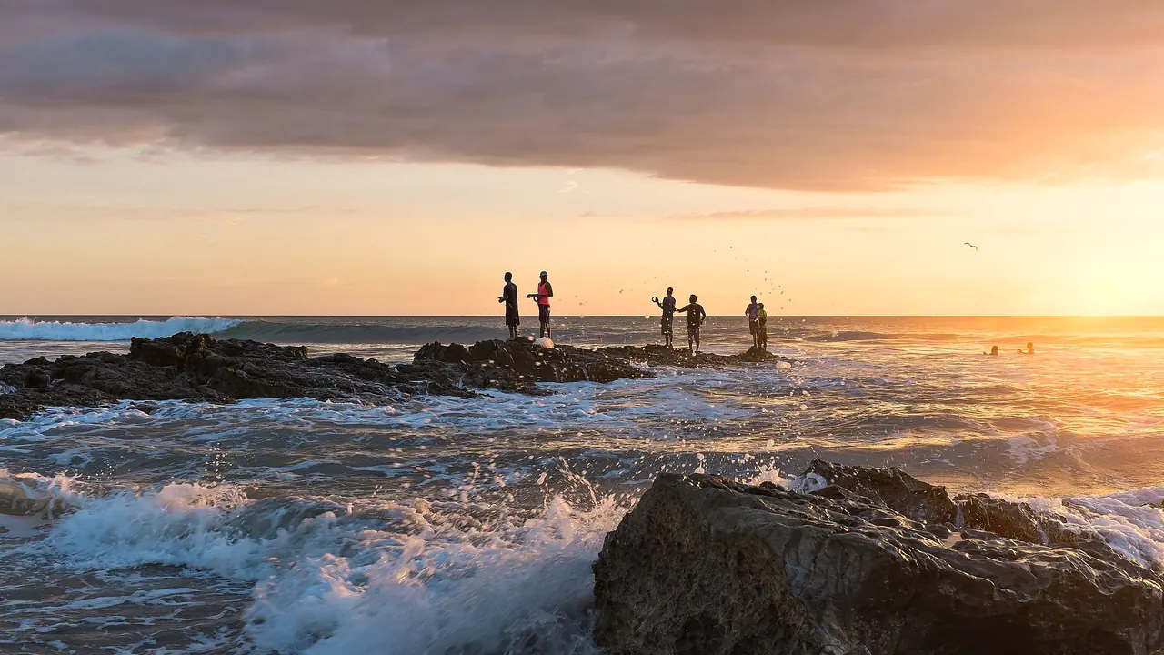
Fishermen on the rocks at Playa Santa Teresa at sunset
- Beaches84
- Nature & outdoors78
- Wellness & relaxation70
Photo: Christopher Crouzet, CC BY-SA 4.0, cropped
Match
34
Every category weighted equally
- Beach & sun45
- Culture & arts23
- Food & nightlife28
- Family trip38
- Outdoors41
- Relax & unwind45
- Shopping & style28
- On a budget33
Santa Teresa, Costa Rica in twelve categories
Our verdict on each, scored 0 to 100 against the same fixed benchmark cities, so a score means the same thing on every page.
Beaches & swimming. Scores 84 out of 100.
Food & drink. Scores 40 out of 100.
Culture & sights. Scores 4 out of 100.
Nightlife. Scores 30 out of 100.
Nature & outdoors. Scores 78 out of 100.
Day trips. Scores 12 out of 100.
Good for families. Scores 35 out of 100.
Getting around. Scores 15 out of 100.
Shopping & style. Scores 12 out of 100.
Affordability. Scores 25 out of 100.
Live music & performing arts. Scores 8 out of 100.
Wellness & relaxation. Scores 70 out of 100.
Santa Teresa, Costa Rica category by category
Beaches & swimming
84The beach is the reason Santa Teresa exists as a destination. A long run of pale sand faces the open Pacific, joined to Playa Carmen in the north and the rockier shore of Mal País in the south, with Playa Hermosa a short ride further up. The water is warm all year, around 28°C, and palms and forest reach almost to the tideline, so the coast still feels wild rather than built up.
This is surf coast first. Waves and rip currents make open swimming risky on many days, especially at mid tide, and careful swimmers look for the rock pools at Mal País at low tide or the calmer corners near the points. Days revolve around the tides and sunsets that pull everyone onto the sand. The drier months bring the brightest water, while the green season brings bigger swell and quieter beaches.
Food & drink
40For a village on a dirt road, Santa Teresa eats better than you might expect. An international crowd of residents has brought wood-fired pizza, poke and sushi, Mediterranean and Israeli plates, Argentine grills, smoothie bowls and serious coffee, mostly served in open-air places under thatched roofs along the main road. The Costa Rican side survives in small sodas serving casados of rice, beans, plantain and fish of the day, and fresh seafood is the best local produce.
What it lacks is a food culture of its own and any real depth: no market, no street food scene, and the same style of laid-back café repeated along the strip. It is a pleasant place to eat for a week, not a reason to come.
Culture & sights
4There are no museums, historic buildings or landmarks in Santa Teresa. It grew from a fishing and farming hamlet into a surf town, and its character lies in its setting and its relaxed, international community rather than in anything to visit. Travellers who want sightseeing should plan it for another part of their vacation.
Nightlife
30Evenings start with sunset drinks on the sand and move to beach bars and open-air restaurants along the main road. A small, well-known party circuit rotates between a few venues through the week, with DJ nights and beach or jungle parties that draw surfers, backpackers and long-stay residents, so on the right night it can go late.
It is still a village. There is no bar district, little choice on any given night, and dusty, unlit roads between venues mean most people ride back on a quad or take a taxi. Many visitors are up at dawn for the surf and treat it as an early-night place.
Nature & outdoors
78Surfing defines the outdoors here: consistent Pacific swell, beach breaks for beginners along Playa Carmen and stronger reef and point waves nearby, with schools and board rentals everywhere. Behind the coast lies tropical dry forest full of howler monkeys, iguanas, coatis and birds, often seen from the road or a hotel terrace.
Cabo Blanco, the country's oldest protected reserve, lies just south, with a forest trail down to a remote beach. Montezuma's waterfalls are a short drive away, boat trips run to Isla Tortuga for snorkelling, and horse riding, fishing, paddleboarding and coastal walks along the rocky Mal País shore fill the rest. The green season makes everything lush but turns the roads to mud; there are no mountains to speak of.
Day trips
12Santa Teresa sits near the remote tip of the Nicoya Peninsula, and there are few other places to visit within easy reach. The hippie village of Montezuma, about forty minutes away, makes a pleasant afternoon with its little centre and seafront, and the fishing settlements around Cóbano and Tambor are workaday rather than sights. Most excursions from here are into the reserves, islands and waterfalls rather than to towns, and anything more substantial means a ferry crossing and a long journey.
Good for families
35Families who come here tend to be outdoorsy ones. Children love the monkeys in the trees, the rock pools at low tide and surf lessons in the gentler white water, and the pace is unhurried. Villa and hotel pools do much of the work.
The difficulties are real, though. Strong currents make the open sea unsafe for young swimmers on many days, and the main road has no pavements and carries a steady stream of quads and motorbikes, with dust or mud on the side roads depending on the season. There are no zoos, parks or attractions designed for children, and medical facilities are basic and some distance away.
Getting around
15Everything strings out along one coastal road that is rough in places, with side roads that turn dusty in the dry season and muddy in the green. There are no pavements and no public transport to speak of within the village, so most visitors rent a quad, a scooter or a bicycle, or rely on taxis. Walking along the beach is often the pleasantest way between neighbouring spots.
Reaching the area is part of the effort: a drive and car ferry across the gulf to Paquera and then the road through Cóbano, a long drive around the peninsula, or a small plane to the airstrip at Tambor followed by a transfer. A four-wheel drive helps on the side roads, especially in the rainy months.
Shopping & style
12Shopping is limited to small boutiques along the main road selling swimwear, linen clothes, surf brands and boards, plus a few stalls with jewellery and beachy home goods. It suits picking up a bikini or a new board, but there is no market, little local craft and nothing worth planning a day around.
Affordability
25Santa Teresa is an expensive place to stay, pricier than most of Costa Rica and well above what many expect from a village on a dirt road. Boutique hotels, villas and the international cafés and restaurants charge close to North American prices, and getting there, renting a quad and booking surf lessons or boat trips add up quickly.
Budget travellers can manage with hostels, shared surf houses and the local sodas, and the beach itself costs nothing, but it is not a cheap tropical escape.
Live music & performing arts
8There is no theatre or concert life. Live music means a band or acoustic set at a beach bar or restaurant, drumming and fire dancing at sunset, or a DJ at the weekly parties. Anyone who wants concerts or performance will not find them here.
Wellness & relaxation
70Yoga is woven into the life of the village. Shalas sit in the forest above the beach, retreat centres run week-long programmes, and drop-in classes, breathwork, meditation and massage are easy to find at every level. Many hotels are built around open decks, plunge pools and hammocks, and the rhythm of surf, rest and sunset gives the days a calm, unhurried shape.
There is no bathing tradition here, no hot springs, hammams or thermal baths, and spa treatments are mostly found in small studios and hotel spas. The dust and quad traffic on the main road can intrude, so the most restful stays are slightly back from it, up the hill or towards the quieter ends of the coast.
When should you go?
Pick a month to see what it is like. The climate figures are measured averages, not a forecast.
Santa Teresa, Costa Rica in July
Daytime high, °C
Rainfall in the month, mm
The whole year
Shaded against this city’s own year: the deepest cell is its best month for that figure and the palest its weakest.
Where the figures come from
Santa Teresa, Costa Rica's temperatures are measured 52 km from the centre, at Puntarenas.
Santa Teresa, Costa Rica has no rain gauge within 25 km of the centre, so its rainfall comes from a gridded climate dataset read at the city rather than from a gauge further away.
Temperature and rainfall are climate normals, averaged over the years shown. Santa Teresa, Costa Rica: 1961-1990 (rainfall 1991-2020) normals, Puntarenas (51.5 km from centre).
Before you go
| Measure | Santa Teresa, Costa Rica |
|---|---|
| Official language | Spanish |
| Currency | Costa Rican Colon (CRC) |
| Sockets | AB120 V, 60 Hz |
| Driving side | Right |
| Time zone | UTC-6 |
| Emergency number | 911 |
| Elevation | 19 m |
| Main airport | Daniel Oduber Quirós International Airport (LIR)113 km from centre30 non-stop destinations |
| Public holidays this year | 11 days |
By the numbers
| Measure | Santa Teresa, Costa Rica |
|---|---|
| Museums within 10 km | 0 |
| UNESCO World Heritage sites within 50 km | 0 |
| Swim season, months above 21 °C | 12 months |
Compare Santa Teresa, Costa Rica with
Every comparison with a written verdict behind it.