North Island or South Island?
Our verdict in twelve categories, each scored against the same fixed benchmark cities, and the climate month by month, so you can choose for your trip.
Choose North Island for
- wellness
- beaches
- live music and the arts
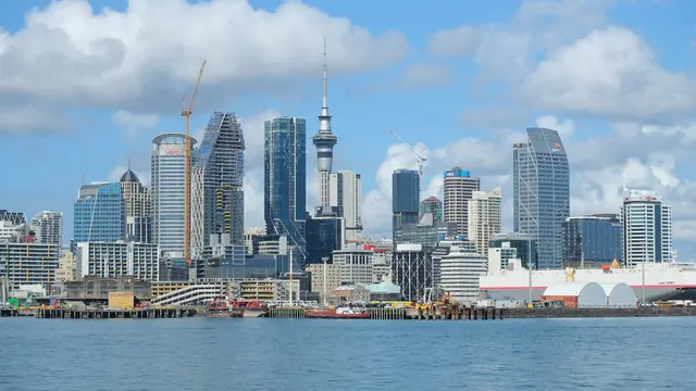
Choose the North Island for a warmer, more varied trip that mixes beaches, cities and hot water. Its northern and eastern coasts give proper summer swimming, Auckland and Wellington have the museums, restaurants, concerts and nights out, and Rotorua's geothermal pools make it the easier island for families and for anyone who wants to soak and slow down.
Choose South Island for
- nature and the outdoors
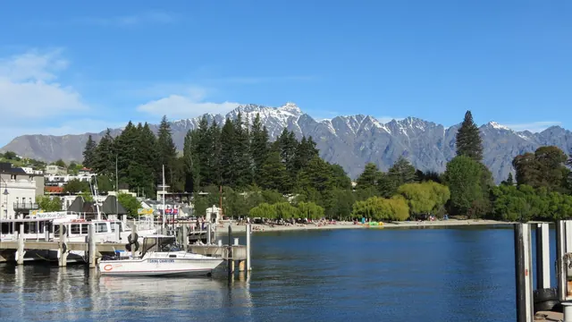
The South Island suits travellers who come mainly for the landscape. The Southern Alps, the glacial lakes of Tekapo and Pukaki, the Fiordland sounds and the West Coast glaciers make it one of the world's great outdoor trips, whether you are tramping, skiing or watching whales at Kaikoura. In return you get a cooler sea, fewer sights and quieter evenings, and Queenstown is the only real place to go out.
Scoreboard
Twelve categories on one fixed scale from 0 to 100. The shaded stretch is the gap between the two.
Your match
Pick a travel style or drag the sliders, and both match scores follow your weighting.
Wins on wellness and beaches with your weighting.
Wins on nature and the outdoors with your weighting.
What matters to you?
Category by category
What the scores mean for a trip.
Beaches & swimming
The North Island is the beach island. The Bay of Islands, the white sand of Hahei and Cathedral Cove on the Coromandel and the town beach at Mount Maunganui give warm, sheltered swimming in summer. The black-sand surf beaches at Piha and Muriwai add drama, as long as you swim between the flags.
On the South Island, real swimming is limited to the top of the island, at Kaiteriteri, the Abel Tasman coves and Golden Bay, where the water is a degree or two cooler. Further south the coast is for looking at: cold, rough shores around Kaikoura and wild driftwood beaches on the West Coast.
Food & drink
The two islands eat about equally well, but in different ways. The North Island's strength is its cities: Asian and Pacific cooking in Auckland along Dominion Road and in the southern markets, and cafés and craft beer around Wellington's Cuba Street. Beyond the cities there are Hawke's Bay reds and a hangi in Rotorua.
The South Island is more about the cellar door and the roadside stall: Marlborough Sauvignon Blanc, Central Otago Pinot Noir near Queenstown, crayfish at Kaikoura and Bluff oysters in winter. Its towns have less range, but lunch at a winery is a reason to linger in itself.
Culture & sights
Neither island has much old architecture, but the North Island has the country's most important sights. Te Papa and the Auckland War Memorial Museum hold the great Maori and Pacific collections, the Waitangi Treaty Grounds mark where the founding treaty was signed in 1840, and in Rotorua carving and weaving are still a living practice. Napier adds a complete Art Deco town centre.
The South Island's heritage is mostly colonial and smaller in scale: Dunedin's Scottish streets and grand railway station, Oamaru's limestone warehouses and the gold-rush cottages of Arrowtown. They make pleasant stops on a road trip, but few are worth a journey on their own.
Nightlife
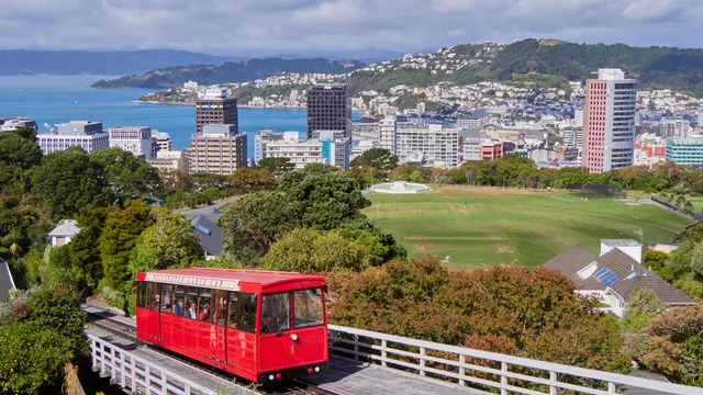
The North Island has two real cities for a night out. Auckland has late bars and small clubs on Karangahape Road and cocktails in Ponsonby, and in Wellington, Cuba Street and Courtenay Place stay busy at weekends.
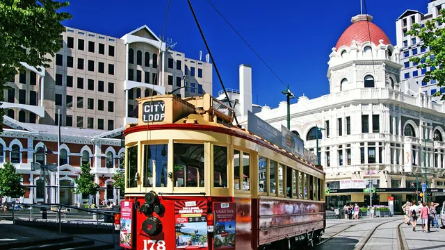
The South Island relies on Queenstown, whose lakeside bars fill with skiers and backpackers, with Christchurch and Dunedin (during university term) as quieter options. Away from these, evenings end early on both islands, but in the South's national-park villages a quiet night is more likely to mean stargazing than a pub.
Nature & outdoors
Both islands are superb for the outdoors, but the South Island works on a larger scale. It has the Southern Alps, Aoraki/Mount Cook above turquoise lakes, the Fiordland sounds at the end of the Milford and Routeburn Tracks, and the Franz Josef and Fox glaciers. That alpine and glacial scenery has no match in the North, and the wildlife adds albatross, penguins and sperm whales.
The North Island's landscape is volcanic rather than alpine: the Tongariro Alpine Crossing past crater lakes, Rotorua's geysers and boiling mud, the glowworm caves at Waitomo and diving at the Poor Knights Islands. It is distinctive and closer to the cities, though less grand.
Day trips
Day trips are a modest pleasure on both islands, and they mostly mean wine country and small towns. On the North Island, the classic outings are the ferry from Auckland to Waiheke, Napier's Art Deco streets with the Hawke's Bay wineries, and the drive over the hills from Wellington to Martinborough and Greytown.
The South Island's equivalents are Arrowtown and the Gibbston Valley from Queenstown, Akaroa's volcanic harbour from Christchurch and Marlborough's vineyards from Nelson. On both islands, the longer journeys are to landscapes rather than to towns.
Good for families
The North Island is the easier island for a family trip. Auckland has a zoo, an aquarium and calm harbour beaches, Te Papa has the best hands-on museum spaces for children in the country, and Rotorua puts luge rides, geysers and kiwi enclosures in one base, with warm summer swimming nearby.
The South Island works well for outdoorsy families, with the Antarctic Centre in Christchurch, Queenstown's gondola and dolphin-watching boats from Kaikoura and Akaroa. The colder sea and long drives between bases are harder going with young children.
Getting around
On both islands a hire car or campervan is close to essential, and the quiet two-lane roads make journeys longer than they look on the map. The difference is in the kind of driving. In the North it means long stretches between Auckland, Rotorua and Wellington, and sprawling Auckland is the hardest city to get around. The South adds mountain passes such as Haast and Arthur's Pass, one-lane bridges and the four-hour drive to Milford Sound.
Without a car, Auckland's harbour ferries and the long train south to Wellington help a little in the North. In the South, the scenic railway crosses the Alps from Christchurch to Greymouth. Neither island's public transport reaches most of the places visitors come for.
Shopping & style
The North Island has the more varied city shopping: local designer labels in Auckland's Britomart and Newmarket, boutiques along Ponsonby Road and vintage shops on Wellington's Cuba Street. The South Island has less, mainly outdoor gear in Queenstown and mainstream stores in Christchurch, though Hokitika is the place to watch pounamu being carved. On both islands, the things to bring home are merino knitwear and greenstone.
Affordability
Both islands are expensive, with costly meals out, car hire and paid experiences. What differs is where the money goes. On the North Island it is the caves, geothermal parks and cultural evenings, and Auckland and the Bay of Islands are the dearest places to stay. On the South Island it is fiord cruises, scenic flights and jet boats, and Queenstown is by far the costliest base.
On either island, self-catering in motels, cabins and campgrounds cuts costs, and the national parks and walking tracks are free. The North also has its big museums, which are free to visit, and the South has its simple conservation campsites.
Live music & performing arts
Wellington makes the North Island the stronger choice for performance. The national symphony orchestra and ballet are based there, and Auckland adds the national opera company and the Civic Theatre with its painted night-sky ceiling. Kapa haka at Rotorua and Waitangi is the performance most visitors remember.
The South Island has the Christchurch orchestra, the restored Isaac Theatre Royal and Dunedin's indie gigs in small venues, but little else worth planning an evening around.
Wellness & relaxation
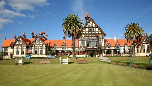
The North Island has far more bathing, and much of it is outdoors and unhurried. There are spring-fed pools at Waikite Valley out in open farmland, warm streams in the forest near Rotorua where people still bathe, and smaller springs scattered from Northland down to the Hauraki Plains. Away from Auckland the pace is easy, and the lakeside towns of the volcanic plateau suit days with nothing planned.
The South Island has fewer pools, but they sit in grander settings. At Tekapo you soak looking over the lake and, after dark, under a night sky few places can match, while the pools at Franz Josef are set in rainforest and Maruia's in beech forest. Here the calm comes less from the water than from the emptiness of lakeside lodges, farm stays and roads that fall silent at night, with busy Queenstown the exception.
When should you go?
Pick your month. The climate figures are measured averages, not a forecast.
North Island in July
South Island in July
Daytime high, °C
Rainfall in the month, mm
Where the figures come from
South Island has no weather station within reach, so its figures come from a gridded climate model rather than a measured record, and read a broad area rather than one spot.
Temperature and rainfall are climate normals, averaged over the years shown. North Island: 1961-1990 (sunshine 1981-2010, rainfall 1991-2020) normals, Auckland Aerodrome Aws (17.2 km from centre). South Island: 1991-2020 normals, TerraClimate 4 km grid at the town, no weather station within 90 km.
The North Island is warm enough for the beach from December to March. Daytime highs reach about 24°C in January and February, the sea holds at around 21°C into March, and January is the sunniest month. From May to September it turns cool and wet, with rain close to 129mm a month. The mild days still suit city walking, and the volcanic plateau gets snow for skiing.
The South Island, measured where most visitors stay, runs several degrees cooler. Summer days reach about 20°C, which is ideal for tramping but rarely beach weather outside the Nelson coast. Winter falls to around 6°C in July, when the ski fields around Queenstown and Wanaka are open. Rain comes all year and is heaviest in spring, peaking in September. February is the best month for a trip that covers both islands: it is warm in the north and at its driest in the south.
Which traveller are you?
On a beach and sun trip, choose the North Island. From the Bay of Islands to the Coromandel and Mount Maunganui, its coasts have warmer summer days and calmer, warmer water. On the South Island, good swimming is limited to the Nelson and Abel Tasman coast.
For an outdoors trip, pick the South Island. Its glaciers, the Southern Alps, the great Fiordland tracks and the whales off Kaikoura give it more variety and scale than the North's volcanic walks, though the Tongariro crossing is still a superb day.
On a relaxing and wellness trip, the North Island wins clearly. Rotorua's mineral pools and mud baths, Taupo's free thermal streams and Hot Water Beach give it far more bathing than the South, where Hanmer Springs is the one spa village.
Before you go
| Measure | North Island | South Island |
|---|---|---|
| Official language | English, New Zealand Sign Language, Māori | English, New Zealand Sign Language, Māori |
| Currency | New Zealand Dollar (NZD) | New Zealand Dollar (NZD) |
| Sockets | I230 V, 50 Hz | I230 V, 50 Hz |
| Driving side | Left | Left |
| Time zone | UTC+12, UTC+13 in summer | UTC+12, UTC+13 in summer |
| Emergency number | 111 | 111 |
| Main airport | Auckland International Airport (AKL)63 non-stop destinations | Queenstown Airport (ZQN)7 non-stop destinations |
| Public holidays this year | 12 days | 12 days |
By the numbers
| Measure | North Island | South Island |
|---|---|---|
| Population | 3,519,800 | 1,115,800 |
| Swim season, months above 21 °C | 1 month | - |
Where else could you go?
Every comparison below shares a destination with this one, so you can follow North Island or South Island somewhere new.