Baden-Baden or Stockholm?
Two destinations compared in twelve categories, each scored against the same fixed benchmark cities. Weight what matters to you and the verdict follows.
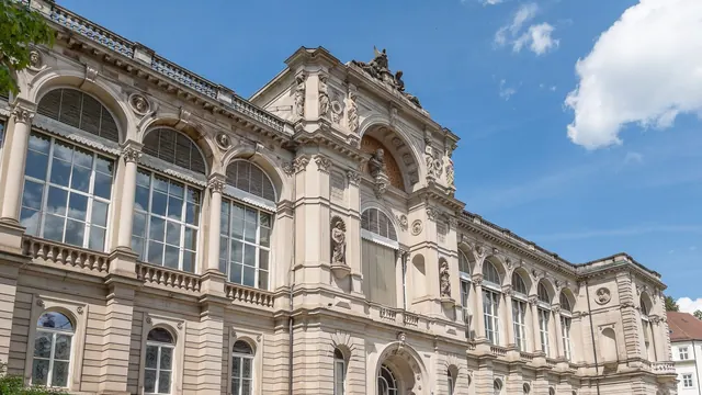
Photo: Kent Wang, CC BY-SA 2.0, cropped
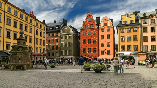
Photo: Jorge Franganillo, CC BY 2.0, cropped
Your match
Wins on wellness and day trips with your weighting.
Wins on nightlife and beaches with your weighting.
What matters to you?
Pick a travel style or drag the sliders. The match scores above update as you do.
Scoreboard
Our verdict on each category, scored 0 to 100 against fixed benchmark cities.
What lies behind each score is written up on the two cities’ own pages: Baden-Baden and Stockholm.
When should you go?
Pick the month you can travel and see both cities side by side. The climate figures are measured averages, not a forecast.
| July | Baden-Baden | Stockholm |
|---|---|---|
| Daytime high | 25 °C | 24 °C |
| Night-time low | 14 °C | 15 °C |
| Rainfall in the month | 117 mm | 60 mm |
| Sunshine | 8 hours a day | 9 hours a day |
| Sea temperature | No sea | 16 °C |
| Daylight | 16 hours a day | 18 hours a day |
The whole year
Each row is shaded against that destination’s own year, so the deepest cell is its best month for that figure and the palest its weakest. Shades are not comparable between the two rows.
Where the figures come from
Stockholm's temperatures are measured 26 km from the centre, at Stockholm Observatoriet.
Temperature and rainfall are climate normals, averaged over the years shown. Baden-Baden: 1991-2020 normals, Baden-Baden-Geroldsau (3.9 km from centre). Stockholm: 1991-2020 normals, Stockholm Observatoriet (26.4 km from centre).
Getting there
| Flying from | Baden-Baden | Stockholm |
|---|---|---|
| LondonLHR, LGW, STN, LTN +2 | 1 h 30 m no fares FKB · 12 km | 2 h 25 m €89-139 ARN · 36 km |
| PalmaPMI | 2 h 0 m no fares FKB · 12 km | 3 h 35 m €193 ARN · 36 km |
| CopenhagenCPH | 1 h 35 m no fares STR · 72 km | 1 h 20 m €84-99 ARN · 36 km |
| OsloOSL, TRF | 2 h 0 m €184-221 2 stops FRA · 143 km | 1 h 5 m €77-102 1 stop ARN · 36 km |
| HelsinkiHEL | 2 h 30 m €239-263 FRA · 143 km | 1 h 10 m €66-74 ARN · 36 km |
| MalagaAGP | 2 h 40 m no fares FKB · 12 km | 4 h 15 m €126-131 ARN · 36 km |
| DubaiDXB, DWC | 6 h 20 m €296-339 1 stop FRA · 143 km | 6 h 20 m €330-429 1 stop ARN · 36 km |
| BangkokBKK, DMK | 11 h 15 m €570-612 1 stop FRA · 143 km | 10 h 25 m €526-560 1 stop ARN · 36 km |
| New YorkJFK, EWR, LGA | 7 h 55 m €537-713 FRA · 143 km | 8 h 5 m no fares ARN · 36 km |
| Punta CanaPUJ | 9 h 30 m no fares FRA · 143 km | 10 h 5 m no fares ARN · 36 km |
The busiest departure cities for these two, with a place kept for each other part of the world. Busiest means arriving passengers where an official count exists, and where none does, the number of non-stop services flown: official route statistics are published by the European reporting countries and by nobody else, so a table ranked on them alone would offer a reader in New York or Tokyo ten European cities. Flying times are estimated from the distance between airports, and every row is a city flown non-stop to both. Where the typical offer connects anyway, the stops are shown. Under each figure is the airport the flight lands at and how far that is from the centre, because the nearest airport is not always the one a route is flown to. Where both columns name the same airport it is one flight, and the difference between the two is the distance printed beside it. Typical return fares for 2026-08 to 2026-10, cached market data up to 7 days old. The figure is the middle half of the offers found, so a single price means they agreed and a range means they did not; for a typical route that middle half spans about a quarter of the median, and for the least settled routes rather more than the median itself.
Before you go
| Measure | Baden-Baden | Stockholm |
|---|---|---|
| Official language | German | Swedish |
| Currency | Euro (EUR) | Swedish Krona (SEK) |
| Sockets | CF230 V, 50 Hz | CF230 V, 50 Hz |
| Driving side | Right | Right |
| Time zone | UTC+1, UTC+2 in summer | UTC+1, UTC+2 in summer |
| Emergency number | 112 | 112 |
| Elevation | 181 m | 22 m |
| Main airport | Karlsruhe Baden-Baden Airport (FKB)12 km from centre43 non-stop destinations | Stockholm-Arlanda Airport (ARN)36 km from centre173 non-stop destinations |
| Public holidays this year | 12 days | 16 days |
By the numbers
| Measure | Baden-Baden | Stockholm |
|---|---|---|
| City population | 56,952 | 984,748 |
| People per km² | 406 | 5,260 |
| Museums within 10 km | 11 | 266 |
| UNESCO World Heritage sites within 50 km | 2 | 3 |
| Swim season, months above 21 °C | - | None |
Where else could you go?
Every comparison below shares a destination with this one, so you can follow Baden-Baden or Stockholm somewhere new.