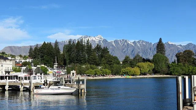
Photos: Bay of Islands by Pseudopanax at English Wikipedia, CC BY 4.0, cropped; South Island by Mark de Jong, Pexels License.
Bay of Islands or South Island?
Our verdict in twelve categories, each scored against the same fixed benchmark cities, and the climate month by month, so you can choose for your trip.
Choose Bay of Islands for
- beaches
- culture and sights
- prices
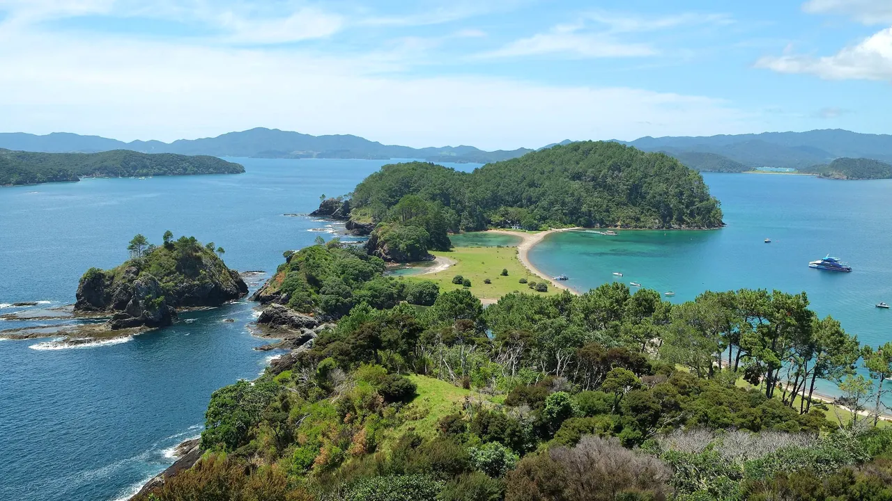
The Bay of Islands suits a slower summer trip from one base: warm, sheltered water, white-sand island coves reached by ferry, dolphins in the bay and the Waitangi Treaty Grounds, where the country's founding story is told. It is the better choice for swimming and for history that carries weight, and for anyone happy with early nights and small-town dining.
Choose South Island for
- food and drink
- nightlife
- nature and the outdoors
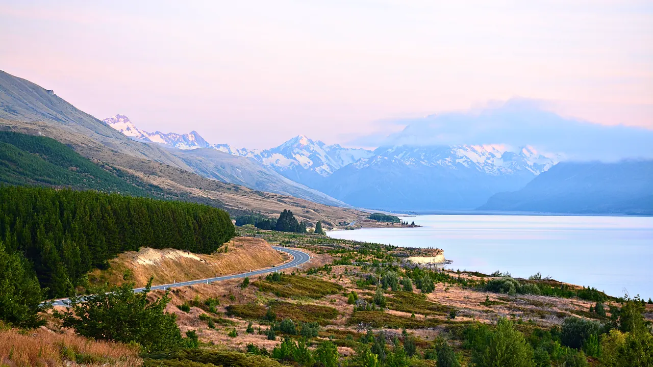
Pick the South Island for scale and variety. The Southern Alps, Fiordland, glaciers, lakes and wine country fill the days, and Queenstown's bars and cellar-door lunches in Marlborough and Central Otago round them off. You'll do more driving in cooler weather and swim less, but for walking, wildlife and mountain scenery it's the stronger trip by a long way.
Scoreboard
Twelve categories on one fixed scale from 0 to 100. The shaded stretch is the gap between the two.
Your match
Pick a travel style or drag the sliders, and both match scores follow your weighting.
Wins on beaches and culture and sights with your weighting.
Wins on food and drink and nightlife with your weighting.
What matters to you?
Category by category
What the scores mean for a trip.
Beaches & swimming
The Bay of Islands is the better place to swim. Its drowned-valley coves stay calm and clear through summer, the sea is a degree or two warmer, and there's a range of beaches close together: Paihia's town beach, Long Beach over the hill from Russell, the white-sand bays of Urupukapuka by ferry, and Matauri and Tauranga Bays a short drive north.
On the South Island, good swimming is limited to the top end, around Kaiteriteri, the Abel Tasman coves and Golden Bay, where the water is clear but cooler. Elsewhere, from the rough east coast to the surf and driftwood of the West Coast, the beaches are for looking at.
Food & drink
The South Island eats and drinks far better. Marlborough Sauvignon Blanc and Central Otago Pinot Noir give it cellar doors and long lunches among the vines. Kaikoura crayfish and Bluff oysters add seafood with a name, and Queenstown and Christchurch have a real range of restaurants.
The Bay of Islands serves fresh snapper, kingfish and oysters on the waterfronts of Paihia and Russell, and Kerikeri has a market in its orchard country. Beyond that, the choice is what a few small towns can offer, with little late or varied dining.
Culture & sights
History counts for more in the Bay of Islands, because this is where the nation began. The Waitangi Treaty Grounds, Christ Church and Pompallier Mission in Russell, and the Stone Store and Kemp House at Kerikeri make a small group of sites. You can see them in two days, and each carries national weight.
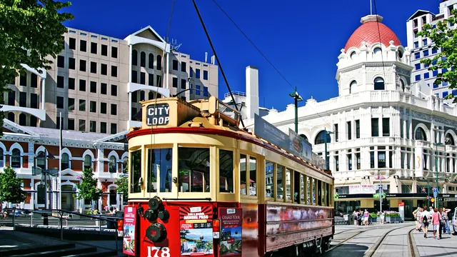
The South Island's heritage is spread more thinly and is mostly colonial. Dunedin has its Scottish streets and Flemish-style railway station, Oamaru its limestone warehouses, and Christchurch its museum and art gallery. There are more handsome buildings to look at, but fewer places that matter as much.
Nightlife
Neither is a nightlife destination, but the South Island at least has Queenstown. Its lakeside bars stay full late in both the ski season and summer, and Christchurch's small clubs and Dunedin's student pubs add more. The Bay of Islands offers a sunset drink on Russell's waterfront and a few backpacker bars in Paihia, and most places close early.
Nature & outdoors
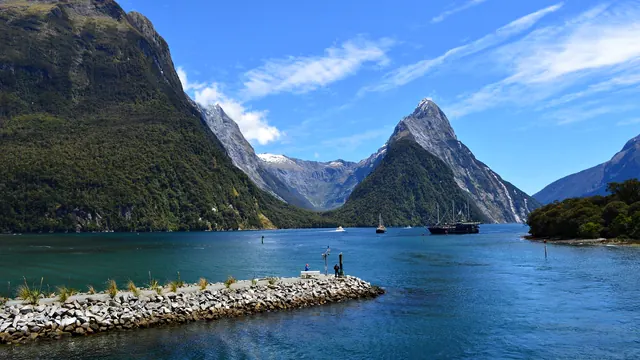
Both are outdoor destinations, but the South Island works on another scale. Aoraki/Mount Cook above Tekapo and Pukaki, the sounds of Fiordland, the Franz Josef and Fox glaciers and the Routeburn and Milford Tracks give it mountains, ice and multi-day tramping. On top of that come winter skiing and albatross, penguins and sperm whales along the coast.
The Bay of Islands is gentler and almost entirely about the water: around 144 islands, sailing and kayaking in sheltered inlets, dolphins that live in the bay all year and the boat run to the Hole in the Rock. Its walks, to Haruru Falls or through Puketi's kauri, are easy, and there are no mountains.
Day trips
The South Island gives more to do on a day out from any base. From Queenstown you can reach Arrowtown, Wanaka and the Gibbston vineyards, from Christchurch Akaroa and Hanmer Springs, and from Nelson the Marlborough wine country. They're modest places, but there are plenty of them.
From the Bay of Islands the choice is thinner and the drives longer. The timber villages of the Hokianga, Mangonui on Doubtless Bay and Whangārei are the main options, and Cape Reinga takes a full day by coach.
Good for families
The South Island has a little more for children: the gondola and luge above Queenstown, the International Antarctic Centre and Orana Wildlife Park in Christchurch, and dolphin trips from Kaikoura and Akaroa. The cost is long hours in the car between bases.
The Bay of Islands gives young children a simpler summer, with shallow island beaches, rock pools, kayaks on calm water and the cultural show at Waitangi all close together. With nothing built for children, though, rainy days are harder to fill.
Getting around
In both, a car does most of the work, but the distances are very different. The Bay of Islands is compact: Paihia, Waitangi and the island wharves are on foot, a ferry crosses to Russell in minutes, and Kerikeri and the northern beaches are short drives.
The South Island is a road trip in its own right, with winding two-lane roads, one-lane bridges and passes such as Haast and Arthur's Pass. Getting from Christchurch to Queenstown takes most of a day. The TranzAlpine train and intercity coaches help, but without a car you lose a lot.
Shopping & style
Shopping in the Bay of Islands means souvenirs, outdoor clothing and some Māori carving and pounamu on Paihia's waterfront, plus galleries, potters and woodturners along Kerikeri's craft trail. The South Island has more worth bringing home: merino and possum-merino knitwear, outdoor gear in Queenstown, greenstone carved in Hokitika's workshops and the widest mainstream choice in Christchurch. Neither is worth the journey for shopping alone.
Affordability
Both are expensive in summer, and for the same reasons: rooms, meals and the paid trips that are the point of going. In the Bay of Islands that means sailing and dolphin cruises. On the South Island it means fiord cruises, scenic flights and the hire car or campervan a long tour needs.
The ways to save differ a little. In the Bay of Islands everything is close, so cabins, self-catering and the cheap Russell ferry go a long way. On the South Island you save by spending less time in Queenstown and more in Christchurch, Dunedin and the Department of Conservation campsites.
Live music & performing arts
The South Island has more to attend, though only in its cities: Christchurch's symphony orchestra, repertory theatre and Isaac Theatre Royal, and Dunedin's small-venue guitar gigs. The Bay of Islands has one memorable performance, the Māori cultural show at Waitangi with haka and waiata in the carved meeting house. Its long-running jazz and blues festival and summer pub bands add a little more.
Wellness & relaxation
In the Bay of Islands, rest comes mostly from the rhythm of the day: still mornings on the water, short drives and early nights. For a soak, the Ngāwhā geothermal pools are half an hour inland from Kerikeri, and a few lodges and day spas around the bay offer massage.
The South Island has more real bathing to plan a stay around. Hanmer Springs is an alpine village that has grown up around its thermal pools since the late nineteenth century. There are also lake-view pools near Tekapo and springs in the beech forest at Maruia.
When should you go?
Pick your month. The climate figures are measured averages, not a forecast.
Bay of Islands in July
South Island in July
Daytime high, °C
Rainfall in the month, mm
Where the figures come from
Bay of Islands's temperatures are measured 78 km from the centre, at Kaitaia.
Bay of Islands has no rain gauge within 25 km of the centre, so its rainfall comes from a gridded climate dataset read at the destination rather than from a gauge further away.
South Island has no weather station within reach, so its figures come from a gridded climate model rather than a measured record, and read a broad area rather than one spot.
Temperature and rainfall are climate normals, averaged over the years shown. Bay of Islands: 1991-2020 normals, Kaitaia (77.6 km from centre). South Island: 1991-2020 normals, TerraClimate 4 km grid at the town, no weather station within 90 km.
The Bay of Islands is at its best from December to April. The days are warm, reaching about 25°C in February, and the sea in the sheltered coves is at its warmest in February and March, at around 21°C. January has the most sunshine. Rain builds through autumn into a wet winter that peaks in July at about 180mm. Winter stays mild enough for walking, but the days are greyer and the sea is too cool for most swimmers.
Treat the South Island's figures as a general guide only, because its weather varies widely across the island and the west is far wetter. They run several degrees cooler than the bay's in every month. Summer highs of about 20°C in January and February are good for walking and touring but rarely warm enough for the beach. July falls to around 6°C, so winter suits the ski fields better than sightseeing. September and October are the rainiest months, and March is wet too. That leaves January and February as the most reliable months on the South Island, a shorter window than the bay's long summer.
Which traveller are you?
On a beach and sun trip, the Bay of Islands is the clear pick. Its sheltered coves are warmer and calmer, the island bays are a short ferry ride away and swimming fits around boat trips. The South Island's good beaches are confined to Nelson and Abel Tasman.
For an outdoors trip, the South Island is one of the great choices anywhere. You get tramping in Fiordland, glaciers on the West Coast, lakes below Aoraki/Mount Cook and skiing in winter. The Bay of Islands offers sailing, kayaking and gentle walks, but no mountains.
On a food and nightlife trip, go to the South Island. Marlborough and Central Otago wine country, Kaikoura crayfish and Queenstown's late bars give it far more to enjoy at the table and after dark. The Bay of Islands eats simply and goes to bed early.
Before you go
| Measure | Bay of Islands | South Island |
|---|---|---|
| Official language | English, New Zealand Sign Language, Māori | English, New Zealand Sign Language, Māori |
| Currency | New Zealand Dollar (NZD) | New Zealand Dollar (NZD) |
| Sockets | I230 V, 50 Hz | I230 V, 50 Hz |
| Driving side | Left | Left |
| Time zone | UTC+12, UTC+13 in summer | UTC+12, UTC+13 in summer |
| Emergency number | 111 | 111 |
| Main airport | Kerikeri Airport (KKE)1 non-stop destination | Queenstown Airport (ZQN)7 non-stop destinations |
| Public holidays this year | 12 days | 12 days |
By the numbers
| Measure | Bay of Islands | South Island |
|---|---|---|
| Population | - | 1,115,800 |
| Swim season, months above 21 °C | 1 month | - |
Where else could you go?
Every comparison below shares a destination with this one, so you can follow Bay of Islands or South Island somewhere new.
- North Islandvs Bay of Islands
- North Islandvs South Island
- Tasmaniavs South Island
- Whitsundaysvs Bay of Islands
- Torres del Painevs South Island
- Patagoniavs South Island